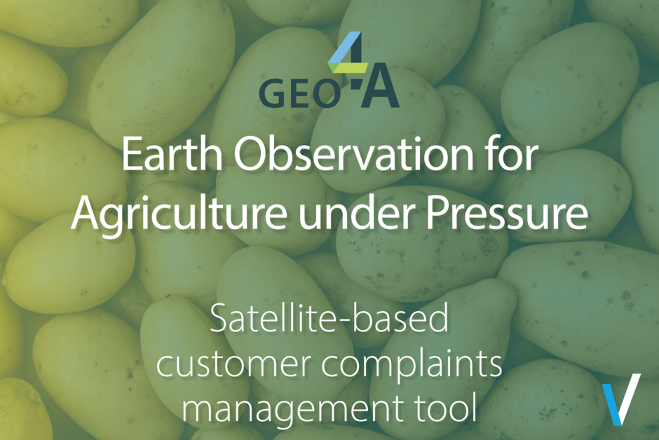
Earth Observation for Agriculture under Pressure
2024-04-15
The effective management of customer complaints stands as a crucial aspect within the potato industry's quality control framework. Our solution proposes innovative strategies to streamline and enhance the management of customer complaints coming from potato value adding clients dealing with food…
Read more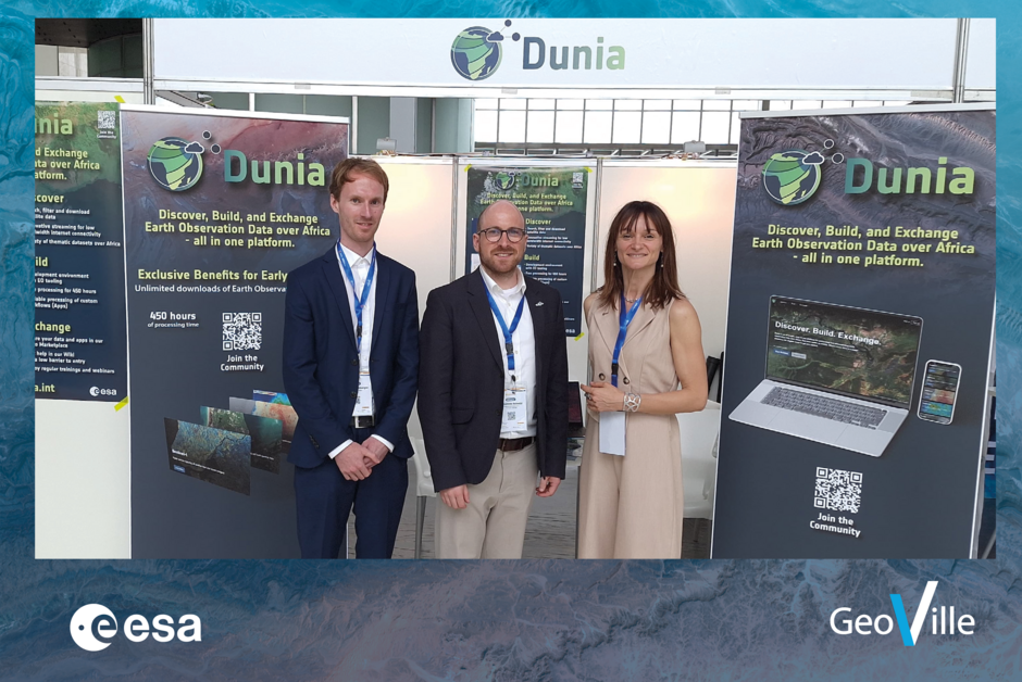
Dunia at the NewSpace Africa Conference
2024-04-03
Dunia is at the New Space Conference Africa in Luanda, Angola talking to important stakeholders of the African Space Industry to reach out and improve the user outreach. Our colleagues Johannes Schmid and Jan Streitenberger are currently in luanda, angola together with Bogdana Tsonevska from ESA…
Read more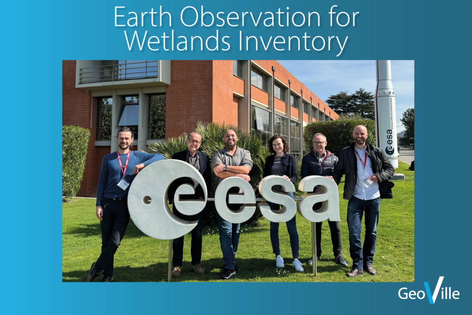
EO4WI Requirement Baseline Review meeting
2024-03-27
EO4WI (Earth Observation for Wetlands Inventory) aims to develop a global solution for wetland inventorying in a close collaboration with user countries. Detecting the location and extent of wetlands on a large scale is the first step and has been well demonstrated in previous projects like…
Read more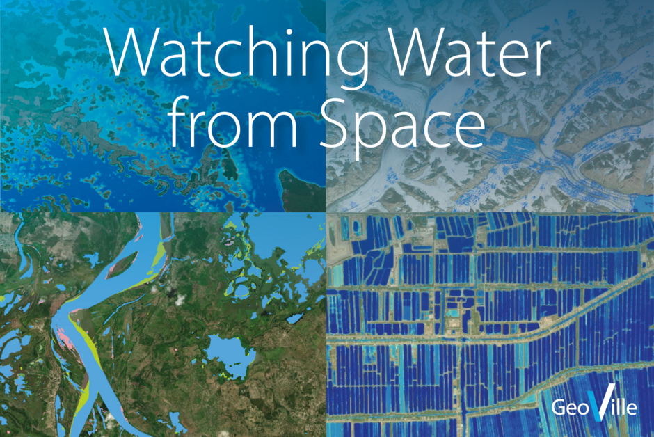
Watching water from space
2024-03-20
Water is rapidly becoming an increasingly critical resource. Climate change, increasing populations and growing urbanisation and deforestation are all putting pressure on the globe’s water resources.
Read more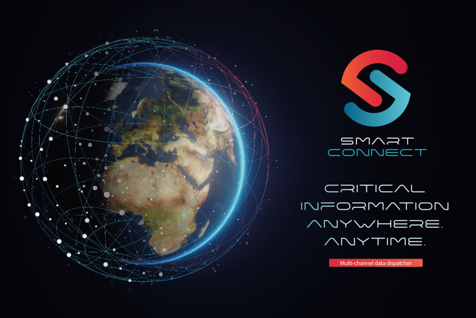
Smart Connect -critical information anywhere, anytime.
2024-03-14
GeoVille together with an interdisciplinary team have been awarded the next ESA partnership project in the "Civil Security from Space" Program, taking on the task of addressing crisis communication challenges. SMART-CONNECT, revolutionizes crisis data exchange capabilities by swiftly and…
Read more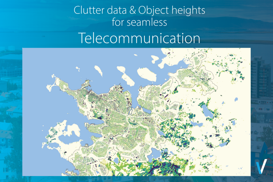
Classification of clutter data and object height for Icelandic telecommunications company
2024-02-22
We support the Islandic telecommunications company Nova through the provision of up-to-date clutter data, detailed object elevation information, and a digital terrain model (DTM) for the entire Icelandic territory (103,000 km²)For the Islandic telecommunications company Nova up-to-date clutter data,…
Read more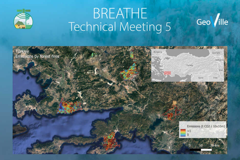
BREATHE Technical Meeting 5 in Ankara
2024-02-12
Another successful BREATHE - EO-based enhancement and verification of GHG inventories for forest and biomass - Technical Meeting 5 took place in Ankara, Türkiye in January 2024 co-organized by GeoVille (Lead) and its Turkish partner Globetech, with the participation of The University of Istanbul,…
Read more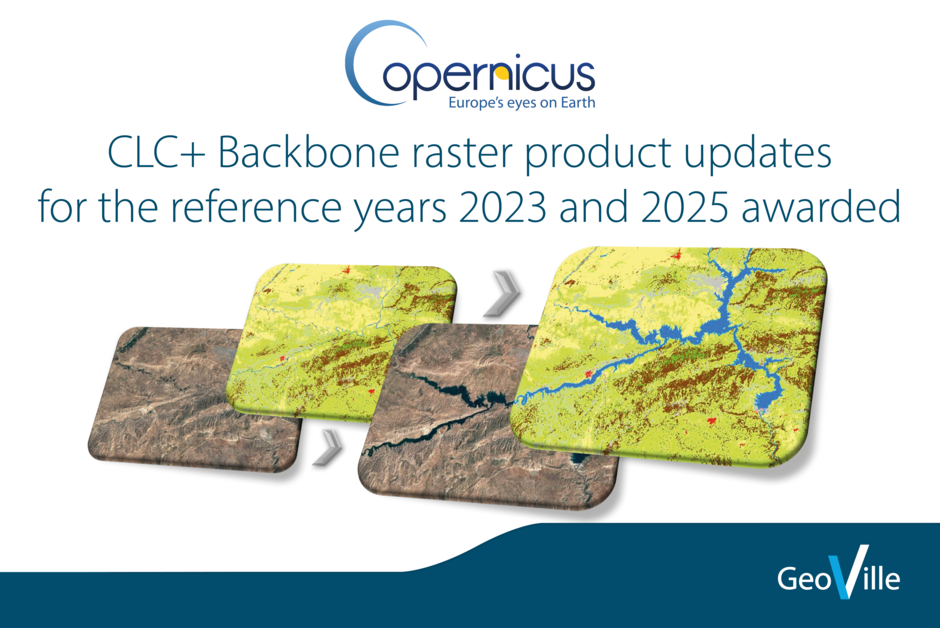
CLC+ Backbone raster product updates for the reference years 2023 and 2025 awarded
2024-01-31
The European Environment Agency (EEA) has awarded an international consortium led by GAF AGwith partners GeoVille, e-GEOS and Telespazio Ibérica, with the production of the updates of the CLC+ Backbone Raster Product for the years 2023 and 2025 as part of the Copernicus Land Monitoring Service…
Read more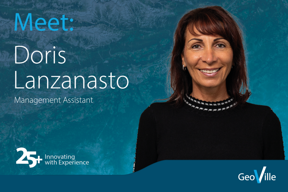
Meet: Doris Lanzanasto
2024-01-26
We are delighted to introduce our new team member Doris Lanzanasto. With experience in event management, including all associated tasks such as organization and planning, support of project partners and accounting, she is a truly valuable addition to the team.
Read more
Merry Christmas and Happy New Year from GeoVille
2023-12-25
As another year draws to a close, we reflect on our amazing journey in 2023! Celebrating 25 years of ‘innovation with excellence’ for our customers. Exciting business activities have unfolded, and existing ones reached new heights.
Read more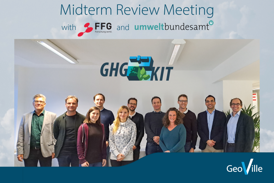
GHG-KIT Midterm Review Meeting with FFG and UBA
2023-12-20
The GHG-KIT Midterm Review Meeting took place last week on the 12th of December in hybrid mode hosted by FFG at their premises in Vienna, with a small committee of in-person participants, including Work Package leads and additional representative(s) of each partner institution: GeoVille (Prime),…
Read more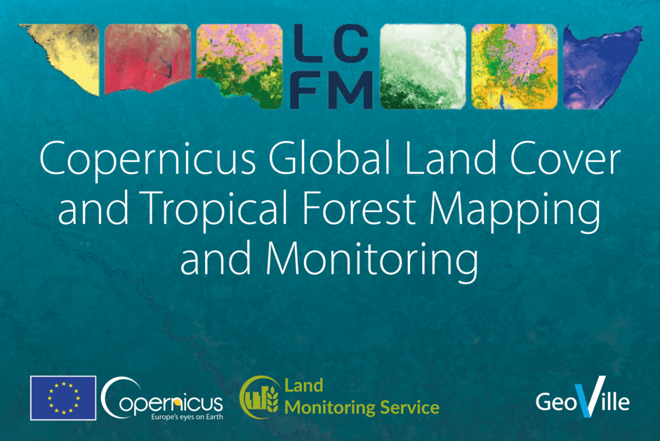
Copernicus Global Land Cover and Tropical Forest Mapping and Monitoring
2023-12-19
In November 2023, the Joint Research Centre (JRC) of the European Commission, in collaboration with a consortium led by VITO, signed a four-year framework contract to implement the new Copernicus Global Land Cover and Tropical Forest Mapping and Monitoring service (LCFM).
Read more
Global Flood Monitoring Report 2022
2023-12-18
The Global Flood Monitoring (GFM) service, operated by a consortium led by EODC, provides a continuous, global, automated and satellite-based flood monitoring product. It is part of the Copernicus Emergency Management Service, managed by the Joint Research Centre of the European Commission. The…
Read more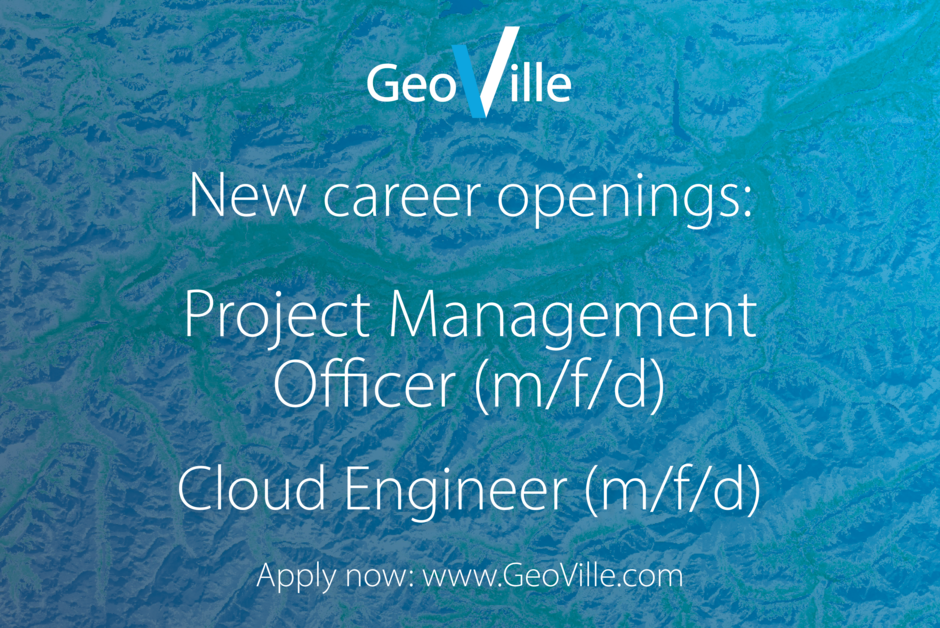
New career openings
2023-12-13
Ready to be a part of cutting-edge projects and contribute to positive environmental change? Join our team at one of Europe's leading companies for satellite-based environmental monitoring! We're looking for motivated individuals to be part of our highly qualified team, making a significant…
Read more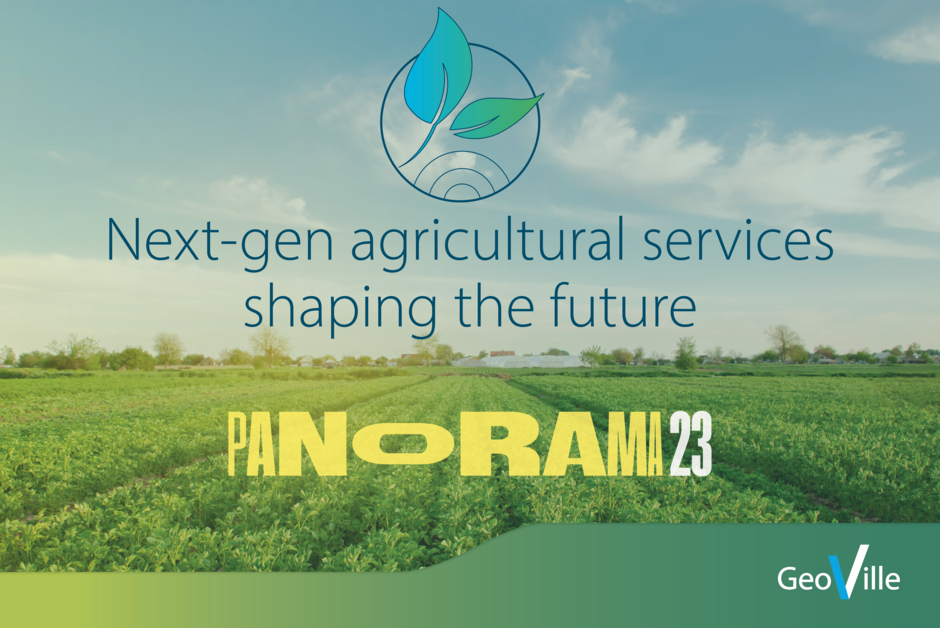
GeoVille presenting next-gen agricultural services shaping the future
2023-12-06
The Agriculture Department of GeoVille took center stage at the @Panorama digitalization festival for agriculture & forestry in Linz/Upper Austria! Three days packed with expert workshops, presentations, and collaborative sessions delving into AI-Business-Integration, IoT, and the journey of…
Read more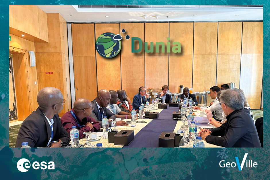
DUNIA gains momentum, attracts interest, and welcomes its first users
2023-12-04
DUNIA of the European Space Agency - ESA EO AFRICA initiative gains momentum, attracts interest, and welcomes its first users!
Read more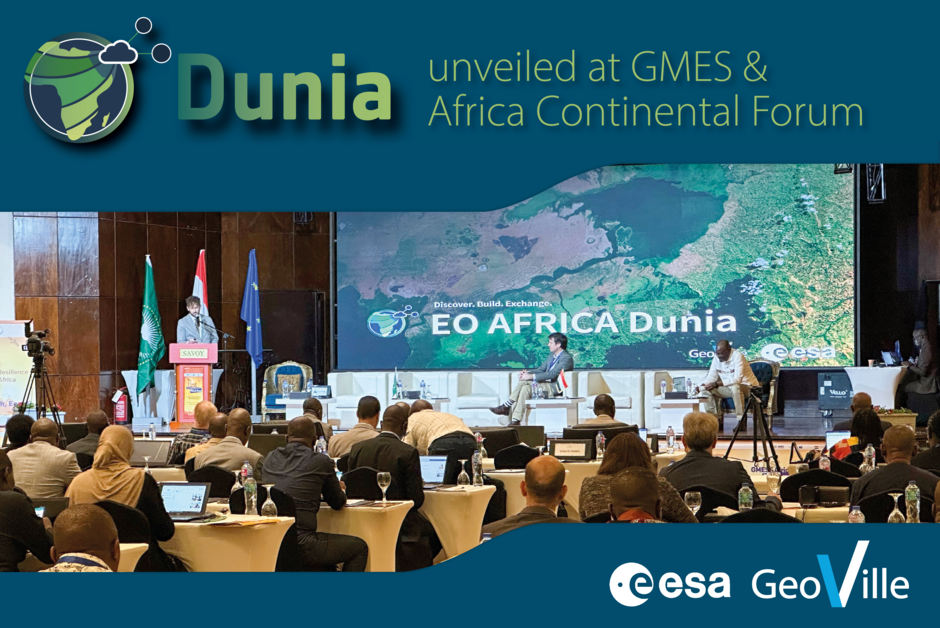
DUNIA unveiled at GMES & Africa Continental Forum, Sharm El-Sheikh (28.11.2023)
2023-11-30
Sharm El-Sheikh, Egypt – 28.11.2023 marks the official presentation of Dunia at the GMES & Africa Continental Forum. DUNIA stands as an innovative, all-in-one solution—a user-friendly data-dissemination and robust data-processing platform designed to elevate Earth Observation services for African…
Read more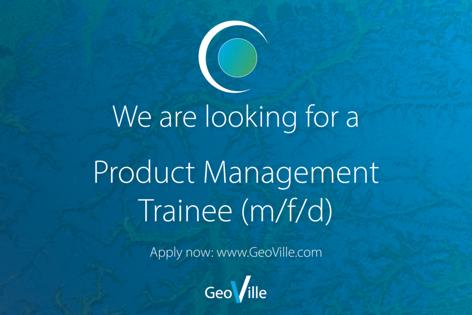
Another exciting opportunity to join our Copernicus Department
2023-11-26
Are you passionate about Earth Observation? Join our Copernicus Department as a Trainee for Product Management (m/f/d) and be at the forefront of solving today's environmental challenges!
Read more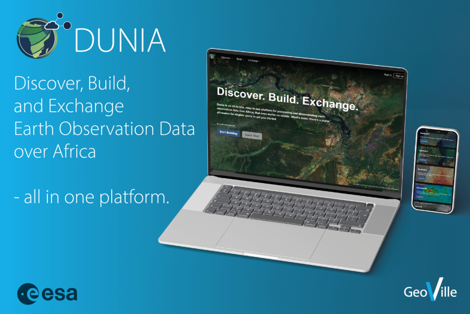
A data platform for Africa: discover Dunia
2023-11-21
Together with our partners, we launched a new service for African data users of Copernicus Sentinels data—to enable fast Earth observation data access for everyone, anywhere and at any time.Dunia is being developed in partnership by a group of leading organisations, each with a proven track record…
Read more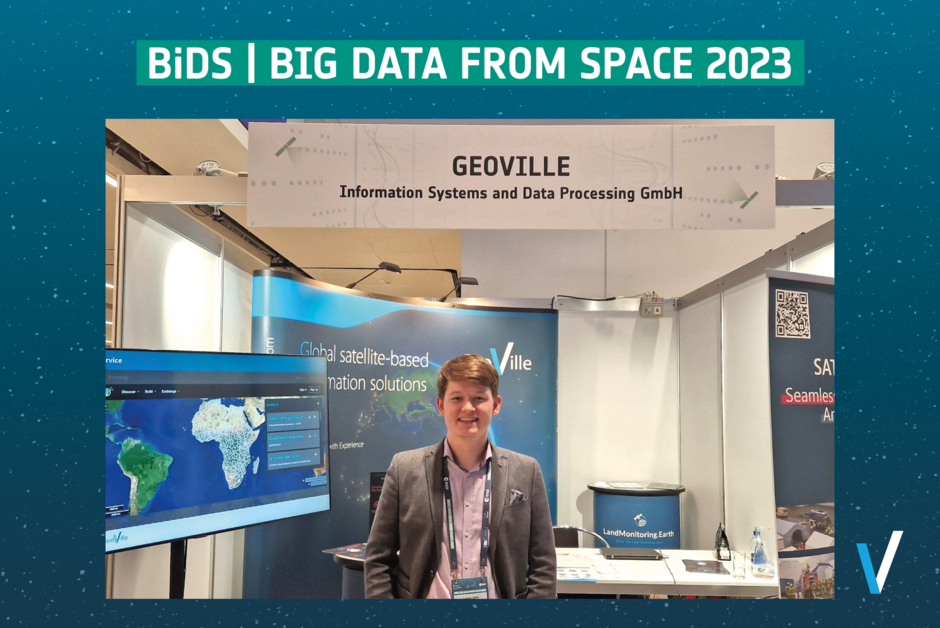
Big Data from Space - Vienna 2023
2023-11-16
Big Data from Space in Vienna was a great success! Exciting talks covered a wide spectrum of technical, theoretical, and business aspects from Earth Observation specialists around the globe. With a wealth of knowledge shared, it's impossible not to feel excited for the near future. Influential…
Read more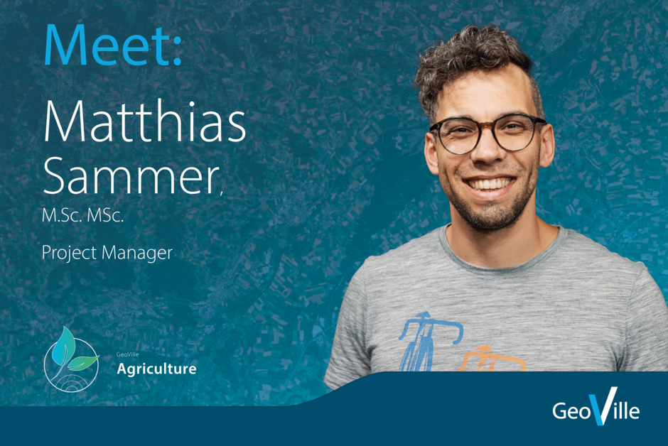
Meet: Matthias Sammer
2023-11-14
Matthias recently joined GeoVille in the role of a Project Manager and is currently working on the development of novel EO solutions for agriculture and climate change adaptation. These will help stakeholders to prepare for climate change impacts. Solutions for monitoring land surface temperature…
Read more
Join our Copernicus Department as Project Manager (m/f/d)
2023-11-08
We are seeking a motivated Project Manager to join our dynamic Copernicus team. You will manage and coordinate developments and project implementations for European and global-scale land monitoring. Work in our international team in Innsbruck and contribute to the booming Earth Observation…
Read more
BREATHE User Meeting 3 / Technical Meeting 4
2023-10-23
The third BREATHE user meeting together with the fourth technical meeting took place on October 18th and were hosted by The Environment Agency Austria (Umweltbundesamt GmbH) at their premises in Vienna, with the in-person participation of ministerial representatives from The Turkish General…
Read more
Ongoing monitoring acitvities to serve the potato industry
2023-10-19
Making practical use of data. Successful completition of the potato monitoring season 2023 GEO4A offers marketable, end-to-end, actionable information service for crop development and quality monitoring and early forecasting of potato yield to the potato industry during potato growing season. The…
Read more
Copernicus Land User Meeting
2023-10-16
On the 28th of September European Environment Agency and JRC invited to the Copernicus Land User Event 2023 with the topic “Urban Applications”. The event focused on the latest developments and urban applications of CLMS. In total there where about 60 physical and around 300 online participants.
Read more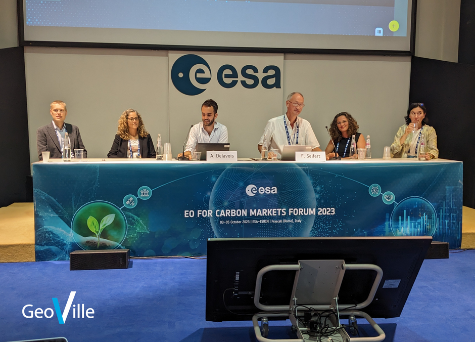
EO for Carbon Market Forum ESA/ESRIN Frascati, Italy 03 to 05 October 2023
2023-10-06
GeoVille actively participated in the First EO for Carbon Market Forum at ESA/ESRIN Frascati, Italy from 03 to 05 October 2023 organized by ESA’s Science, Applications and Climate Department with support from the European Commission DG CLIMA and Equinor.
Read more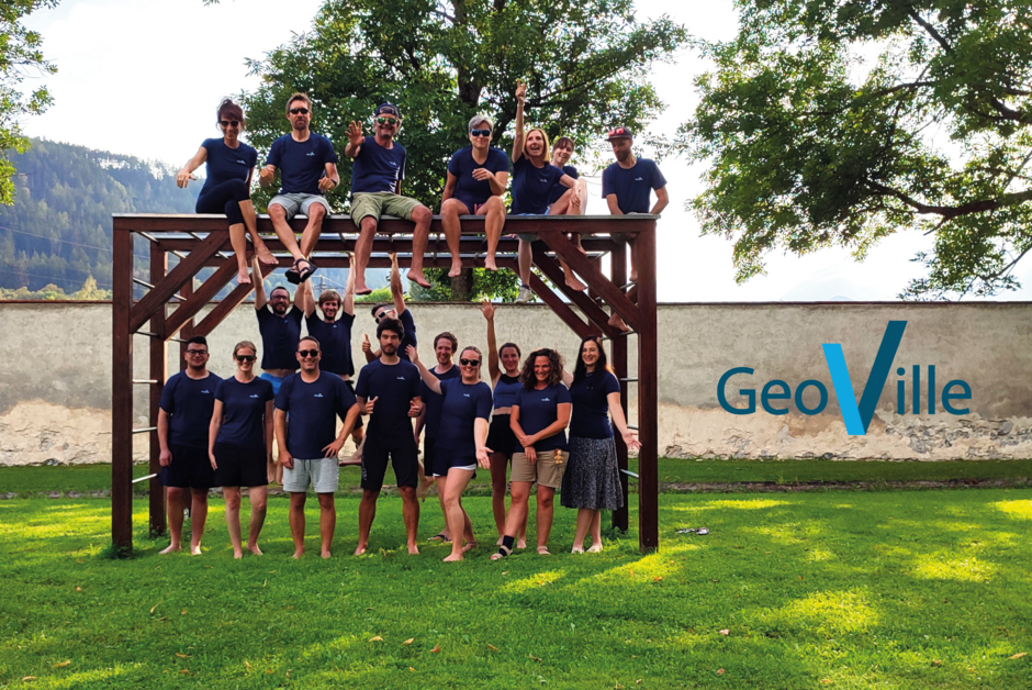
GeoVille Funday 2023
2023-10-04
As autumn slowly shows its colours, we can't help but look back at the fantastic summer in Innsbruck and our unforgettable 4th Annual GeoVille Funday! As usual, we took the fun to the beach area of the Sports Leopold-Franzens Universität Innsbruck.
Read more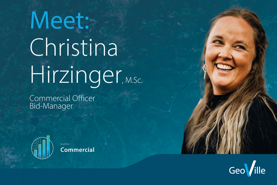
Meet: Christina Hirzinger
2023-09-21
We are very pleased to introduce a highly valued person within our GeoVille family - Christina! With an impressive experience within the company, spanning over 10 years in total, Christina has become an integral part of our team, infusing her expertise and charisma into most facets of our company…
Read more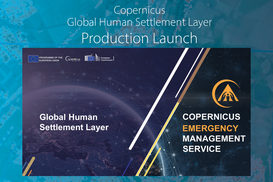
Copernicus Global Human Settlement Layer Production Launch
2023-09-05
Joint Research Centre and service providers launch the production of the new generation of the Copernicus Global Human Settlement Layer The Copernicus Global Human Settlement Layer (GHSL) is the Exposure Mapping Component of the Copernicus Emergency Management Service, implemented by the European…
Read more
Join our team as a Cloud Application Developer or Junior IT Project Manager
2023-08-31
Are you ready to take your expertise to new heights? This is your opportunity to collaborate with our specialised departments in devloping innovative solutions for satellite-based environmental observation.
Read more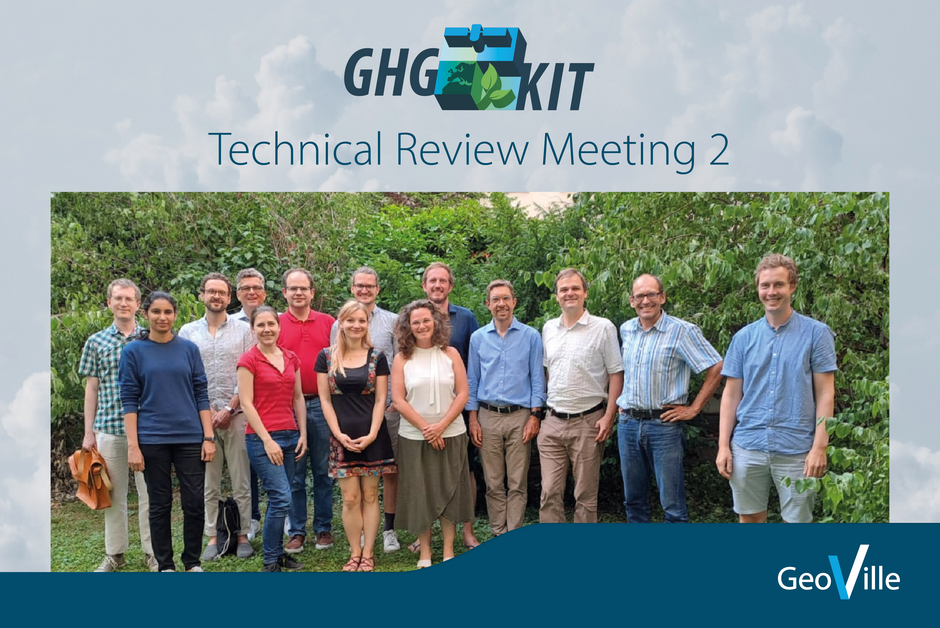
Technical Review Meeting 2 with FFG and UBA for Concept Design
2023-08-29
The GHG-KIT second Review Meeting with The Austrian Research Promotion Agency (Forschungsförderungsgesellschaft, FFG), The Environment Agency Austria (Umweltbundesamt GmbH, UBA) and The Austrian Federal Ministry for Climate Action, Environment, Energy, Mobility, Innovation and Technology…
Read more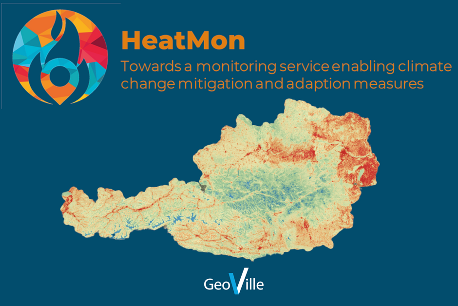
HeatMon Kick-Off
2023-08-21
HeatMon project was initiated, to develop and refine methods for a satellite-based heatmap at high temporal and spatial resolution. The project focuses on monitoring road surface temperatures, providing climate change-related indicators for land use and spatial planning, and supporting the SDG…
Read more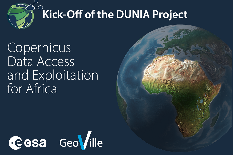
Kick-Off of the DUNIA Project - Copernicus Data Access and Exploitation for Africa
2023-08-10
Beginning of July, the European Space Agency - ESA Dunia EO Africa KO event took place with GeoVille as the prime contractor. Our team and partners are working on a Service that will enhance the usage of Copernicus data in Africa.
Read more
We're Hiring at GeoVille!
2023-08-01
Join the world of GeoVille. We provide a fascinating work environment and job security.
Read more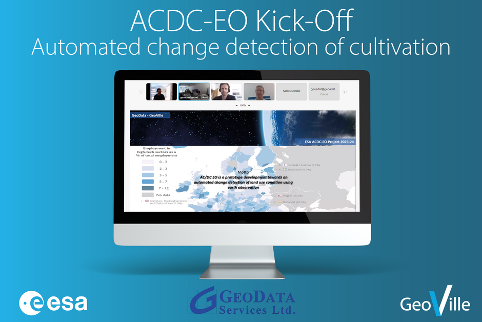
Automated change detection of cultivation
2023-07-25
The project not only has an interesting name but also an interesting focus. The main focus of the project is change detection in agriculture through the utilization of EO-based markers. The project consortium, consisting of GeoVille and GeoData Services (a Hungarian-based company), will be executing…
Read more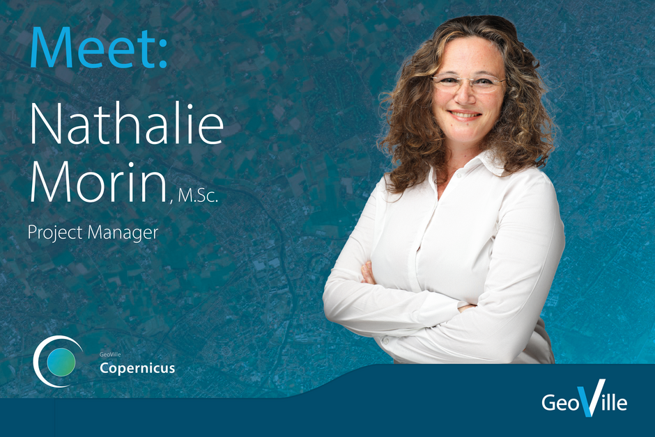
Meet: Nathalie Morin
2023-07-19
Nathalie Morin is a French remote sensing engineer specialized in forestry and has over 15 years of international experience in project management for GIS and remote sensing applications. Nathalie joined GeoVille in 2022 and is highly focused on accountability, results and collaborative team work,…
Read more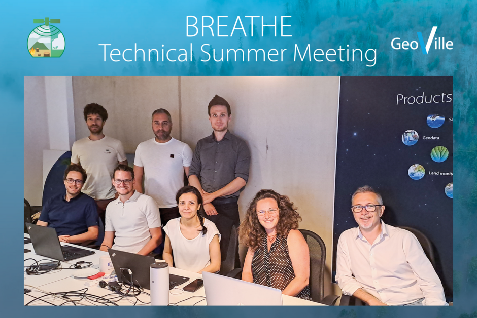
BREATHE Technical Kick-Off Summer Meeting
2023-07-11
The BREATHE Technical Meeting took place on the 21st of June in Innsbruck. This time, it was GeoVille hosting it’s Turkish partner Globetech and the three subcontractors, Environment Agency Austria (Umweltbundesamt UBA), SISTEMA and University of Vienna. This is the 3rd meeting that took place…
Read more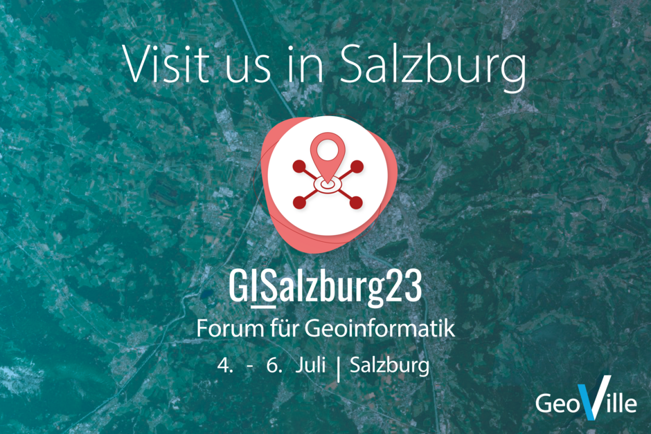
GeoVille at GI_Salzburg 2023
2023-07-03
Join us at booth number 5 from July 4th to 6th at the GI Salzburg 2023 in beautiful Salzburg! The GI_Salzburg is a premier event for geospatial enthusiasts, bringing together experts from around the world. Discover the latest advancements in geospatial technology, network with industry…
Read more
IDEAtlas - developing AI-based methods
2023-06-14
IDEAtlas, an ESA-funded project, is aiming to develop, implement, validate and showcase advanced AI-based methods to automatically map and characterize the spatial extent of slums from Earth Observation (EO) data.
Read more
Global Flood Monitoring - Global Product Validation
2023-06-07
The Global Flood Monitoring (GFM) project provides an automated, global, satellite-based flood monitoring product, enabling a continuous global, systematic monitoring of flood events. The GFM is part of the Copernicus Emergency Management Service, which is managed by the Joint Research Center of the…
Read more
BREATHE: Technica Meeting 2 in Ankara
2023-06-01
Another successful BREATHE meeting in Ankara! The Technical Meeting 2 took place hybrid, online and in-person in Ankara, at Turkish partner GlobeTech’s premises on Hacettepe University campus on the 25th of April 2023. One of the main scopes of this meeting was achieved with the integration of…
Read more
Team Highlight: Katja Kustura
2023-05-30
Katja recently joined GeoVille's Earth Observation Unit, where she is currently working on developing satellite image processing workflows, and conducting comprehensive modeling and analysis of satellite imagery. Katja moved to Innsbruck in 2016 to pursue her PhD at the Institute for Theoretical…
Read more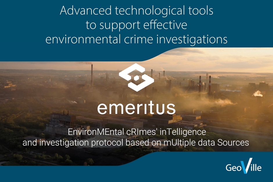
Advanced technological tools to support effective environmental crime investigations
2023-05-22
EMERITUS is a #HorizonEurope innovation project that aims at aggregating advanced technological tools in a single-entry digital point platform. This is intended to support Law Enforcement Authorities (LEAs) and Border Guards (BGs) in the effective investigation of environmental crime at national and…
Read more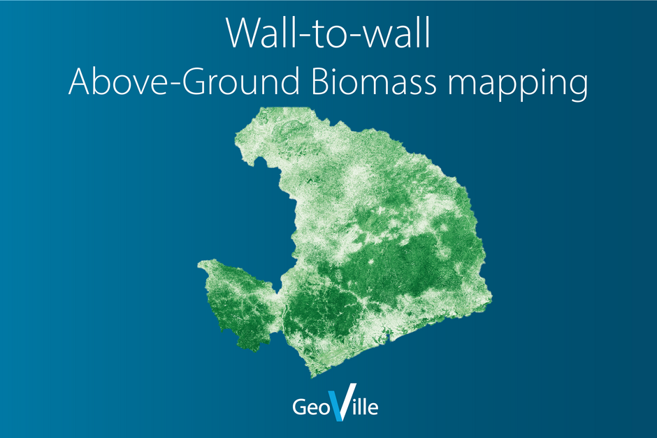
Wall-to-wall Above-Ground Biomass (AGB) mapping
2023-05-10
In a joint cooperative between ESA´s Global Development Assistance (GDA) Climate Resilience project and a WorldBank (WB) funded proof-of-concept for a modern MRV2.0 (Monitoring, Reporting and Validation), the partners aim to improve the accuracies and reduce the efforts required for countries…
Read more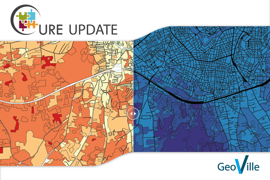
Introduction of the CURE (Copernicus for Urban Resilience in Europe) Portal
2023-05-02
The 6th issue of the CURE (Copernicus for Urban Resilience in Europe) Newsletter introduces the CURE Portal and its components/capabilities as an online tool supporting urban resilience stakeholders.
Read more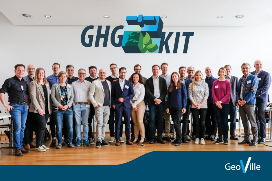
First GHG-KIT Review Meeting with FFG and Umweltbundesamt
2023-04-20
First GHG-KIT Review Meeting with FFG and Umweltbundesamt on User Requirements and Technical Specifications.
Read more
AI based field delineation
2023-04-11
Agriculture has become increasingly important in the face of growing population and climate change. New monitoring technologies enabled through continuous satellite observations can help to improve the efficiency of food production down to the level of individual fields. To achieve this, it is…
Read more
Dreaming of a career in Earth Observation? We're hiring!
2023-04-04
Dreaming of a career in Earth Observation? We're hiring! Apply today at GeoVille. We are currently seeking talented individuals to fill three key positions in our Innsbruck office. We are looking for an IT Operator, a Project Manager, and an Administrative Assistant to join our dynamic and…
Read more
IG3IS Stakeholder Consultations and User Summit
2023-03-30
The IG3IS Stakeholder Consultations and User Summit took place at the World Meteorological Organization (WMO) Headquarters, Geneva, Switzerland beginning of February 2023, following the Scientific Conference on International Greenhouse Gas Monitoring Symposium, where Marcus Hirtl from GeoSphere,…
Read more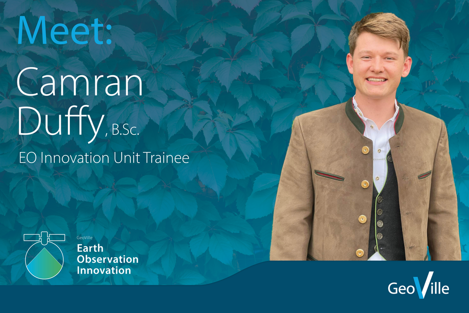
Team Highlight: Camran Duffy
2023-03-15
Camran is a talented trainee at GeoVille, working in the EO Innovation Unit, developing unique approaches to solving the challenges we face. He loves speeding down slopes or riding his bike down mountain trails in the surroundings of Innsbruck, but he is also very passionate about developing…
Read more
BREATHE Technical Kick-off Meeting and 1st User Meeting in Ankara, Turkey
2023-03-09
Successful and promising start of the BREATHE project, “Earth observation Based Enhancement and Verification of Greenhouse Gas (GHG) Inventories for Forest and Biomass, with the Technical Kick-off Meeting and 1st User Meeting, which took place end of January in Ankara, Turkey, on the campus of the…
Read more
GDA AID Water Resources Kick Off
2023-02-23
Global Development Assistance - Agile EO Information Development (GDA AID)’s latest initiative on Water Resources kicked off early February with the participation of both the European Space Agency - ESA GDA team and members from the consortium led by EOMAP (Germany).
Read more
CLC+ Backbone Raster Data for 2018 published by EEA
2023-02-15
We are happy to announce that the CLC+Backbone raster product for 2018 was published by the EEA and is available for download via the Copernicus Land Portal
Read more
Successful completion of the Potato Monitoring Season 2022
2023-02-06
Together with our partner GEO4A in Emmeloord (NL) - the world potato city - we achieved great results in the year 2022. Over the entire potato season, we were able to determine reliable and gap free biophysical indices on potato growth via satellite data in the European Potato Belt covering…
Read more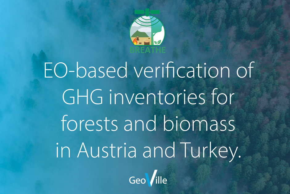
BREATHE project “Earth Observation based enhancement and verification of GHG inventories for forest and biomass” kick-off
2023-01-04
In the continuity of the Austrian flagship project GHG-KIT “Prototyping an EO-enabled kit supporting greenhouse gas reporting, the BREATHE project focuses more specifically on EO-based enhancement and verification of GHG Inventories for forest and biomass in the two countries Austria and Turkey.
Read more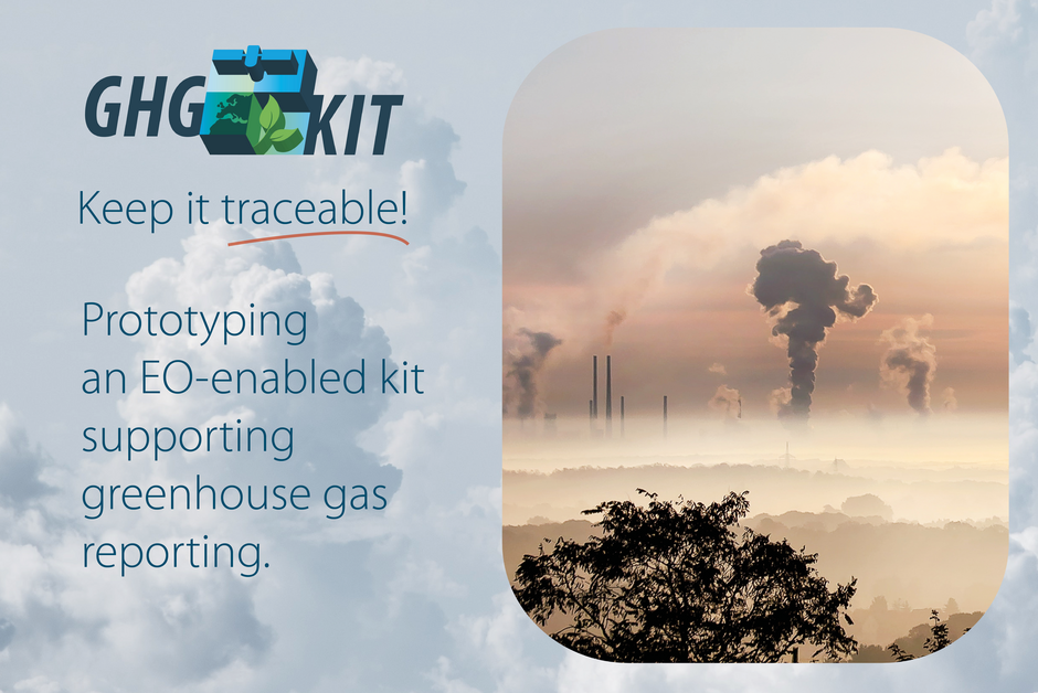
Start of the Austrian flagship project GHG-KIT
2022-10-21
“GHG-KIT: Keep it traceable” is being developed through a unique cooperation between a multi-disciplinary Austrian industry-science team and international experts. The resulting blueprint for system and service implementation will be a major milestone towards a new national greenhouse gas monitoring…
Read more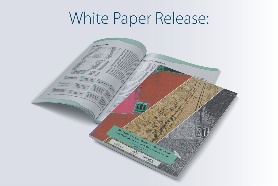
White Paper Release: Opportunities for Earth Observation and Agricultural Index Insurance
2022-09-27
“The Challenges of Index Insurance: Best practices for the Earth Observation Sector”. This special report focuses exclusively on index insurance as a risk management instrument in agriculture and applying satellite data and technologies to enhance existing insurance solutions.
Read more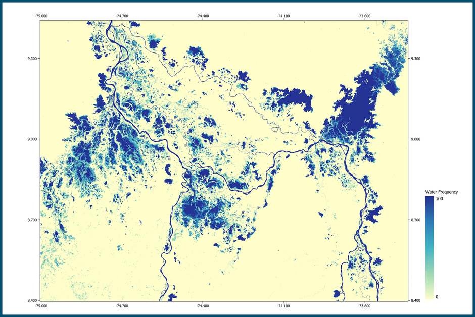
Outstanding performance of GeoVille surface water mapping algorithm
2022-09-14
Climate change, increasing population and land use are all rapidly driving the need to improve the knowledge of surface water dynamics. Therefore, a round robin exercise was organized within the ESA funded WorldWater project.
Read more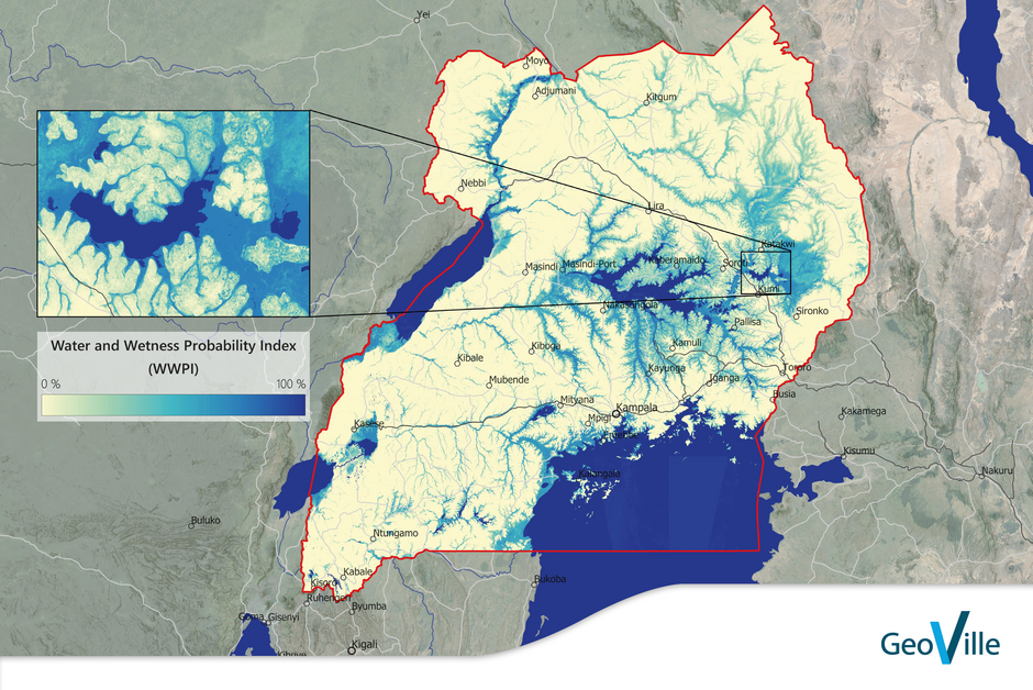
Wetland Management: End-to-end processing of spatial and temporal indicators on wetland status and trends
2022-08-23
GlobWetland Africa was initiated by ESA to facilitate the exploitation of satellite observations for the conservation, wise use, and effective management of wetlands in Africa.
Read more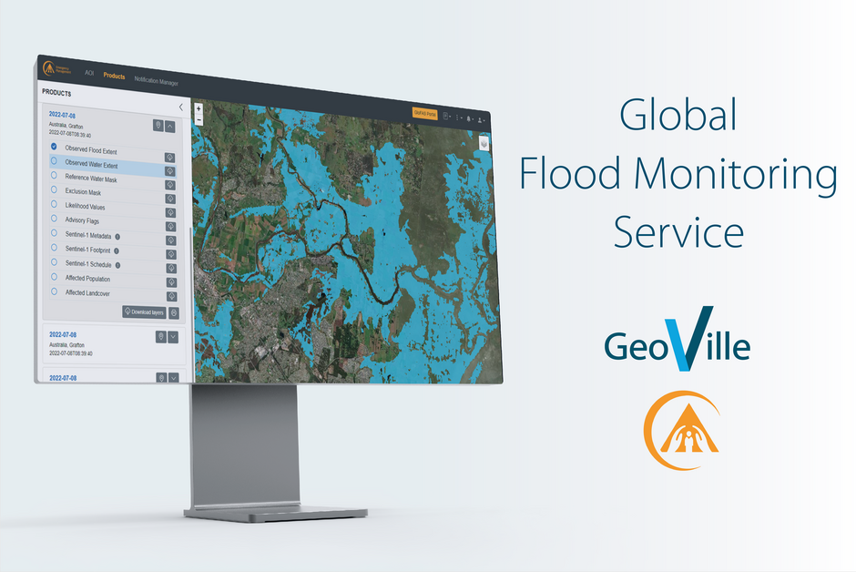
The first Global Flood Monitoring Service is operational
2022-08-18
The first fully automatic, global, Sentinel-1 based flood identification and monitoring service is operational. A Web application allows users to download the data (all flood product layers, NRT and archives) and receive web push notifications for their specified areas of interest for detected flood…
Read more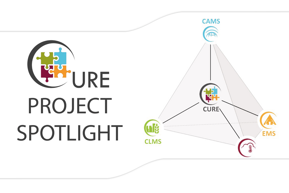
Synergistically exploiting the Copernicus Core Services. Developing an umbrella cross-cutting application for urban resilience
2022-07-18
CURE synergistically exploits the Copernicus Core Services and develops an umbrella cross-cutting application for urban resilience in DIAS (Data and Information Access Services), consisting of 11 individual cross-cutting applications for climate change adaptation/mitigation, energy and economy, as…
Read more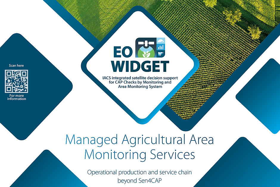
Widget-based Managed Agriculture Area Monitoring Service supporting the CAP
2022-05-31
GeoVille and its partner EOX GmbH introduce a widget-based Managed Agriculture Area Monitoring Service supporting the CAP Checks by Monitoring and Area Monitoring System.
Read more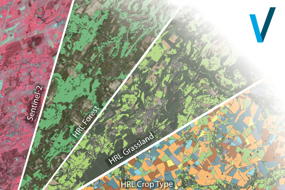
New Copernicus Land Monitoring Service - Enabling High-Resolution Vegetation Monitoring in Europe
2022-03-27
Copernicus Land Monitoring Service: Consortium of GAF, GeoVille and VITO starts High Resolution Layer Vegetated Land Cover Characteristics Project. The European Environment Agency (EEA) recently awarded a contract to a consortium under the lead of GAF with the partners GeoVille and VITO to…
Read more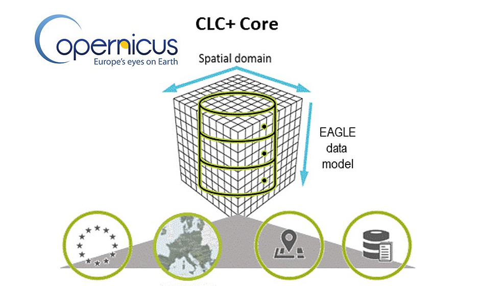
Empowering the new generation of European Land Cover and Land Use information: CLC+ Core to give a further boost to the CLMS
2021-03-22
The next step towards implementing the new ground-breaking standard in Copernicus Land Monitoring has been initiated with the kick-off of the CLC+ Core initiative in December 2020.
Read more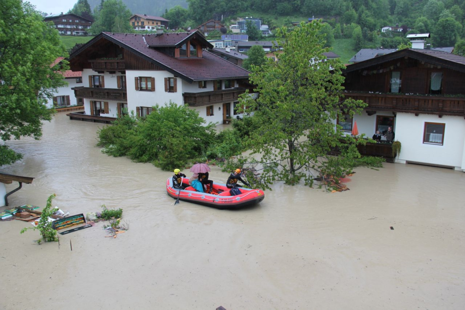
First fully automated, global Flood Monitoring Service for the Copernicus Emergency Management Service
2020-12-14
On 27th November and 2nd December representatives of the Global Flood Monitoring Alliance successfully kicked off the global satellite-based flood monitoring service (GSFM) coordinated by the Joint Research Centre (JRC). The service aims at the development and operation of a fully automatic global,…
Read more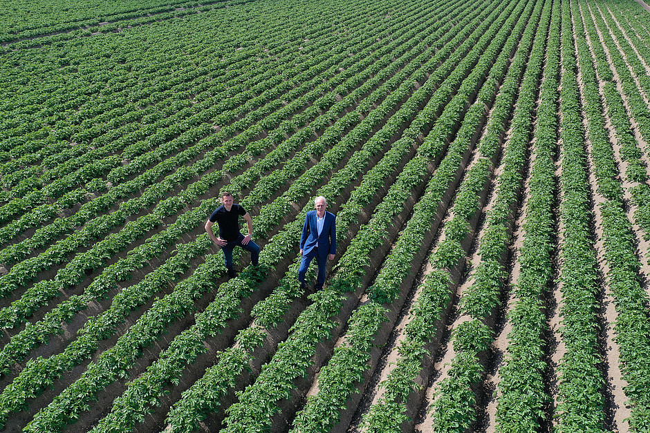
Breeders Trust invests in variety recognition using Geo4A satellite technology
2020-06-25
Through our subsidiary Geo4A that focuses specifically on services for the agricultural sector GeoVille could built up a strong position in the potato sector in the last two years. A recent success is todays signature of a major contract with the Brussels-based Breeders Trust, which is seen by all…
Read more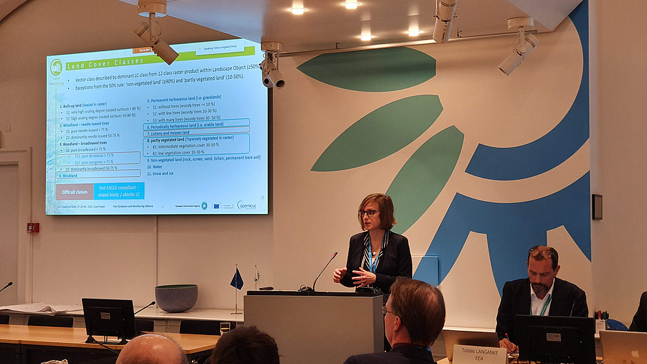
CLC+ Backbone has officially been kicked off
2020-05-13
We are delighted to announce that GeoVille GmbH will play a key role in implementing the new CLC+ Backbone, the new ground-breaking standard in Copernicus Land Monitoring, which has officially been kicked off in February 2020.
Read more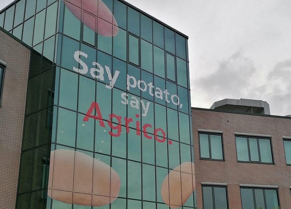
It’s all about potatoes – on-site acceptance test successful
2020-04-10
It’s all about potatoes – the on-site acceptance test was successfully carried out as ‘online acceptance test’ for the ESA InCubed EO PLUG-IN activity. The current Covid-19 pandemic changes the way we work, but representatives of ESA, GeoVille, GEO4A and Agrico have successfully tested the first…
Read more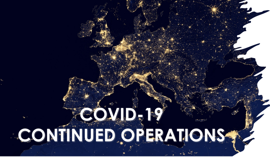
CORONAVIRUS (COVID-19) UPDATE – CONTINUED OPERATIONS
2020-03-17
GeoVille takes the recent situation regarding the coronavirus (COVID-19) very seriously and has taken comprehensive precautionary measures. For operational services we maintain proven business continuity plans, including back-office locations and all our staff is technically equipped to work from…
Read more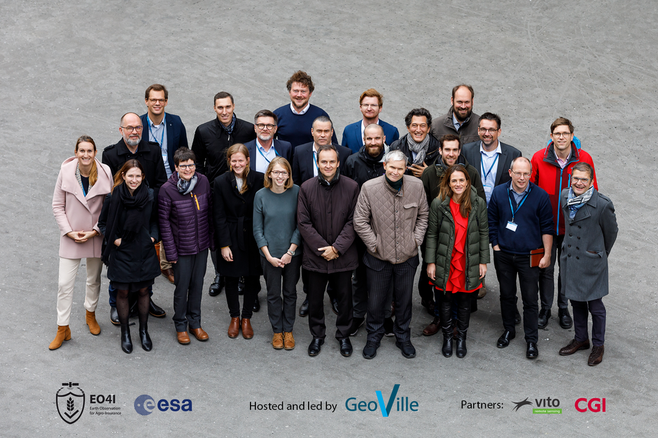
Earth Observation for Agro-Insurance
2019-12-02
On 21 and 22 November 23 representatives of global First- and Re-Insurances, ESA and EARSC met at GeoVille in Innsbruck to discuss the challenges and fitting Earth observation solutions for the sector. This is already the second large scale user workshop in the frame of ESA’s Earth Observation Best…
Read more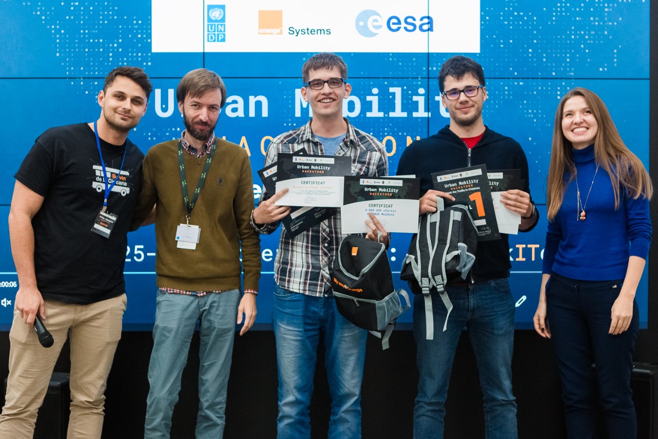
Urban Mobility Hackathon in Chișinău
2019-11-04
Last week, GeoVille was part of the Urban Mobility Hackathon in Chișinău. The core objective of the Hackathon was to open-up available geospatial data to IT experts, data analysts and urban developers to analyse the city’s development patterns and model new solutions to improve urban mobility.
Read more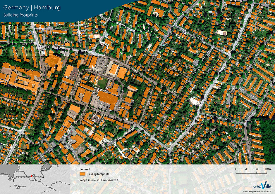
Fully automated processing chain for building footprints
2019-10-14
Last week GeoVille and its partners from FH Kufstein and FH St. Pölten met in Kufstein to complete the project InfraBASE.
Read more
GeoVille joins World Space Alliance
2019-09-27
Today GeoVille joined the World Space Alliance (WSA) partnership – a digital market place to help bring satellite data to the market.
Read more
Copernicus land product on coastal zones
2019-09-19
GeoVille is excited to be part of the industrial consortium led by Planetek Italia (Italy), and supported by Telespazio Ibérica (Spain) and Planetek Hellas (Greece) that will implement the Copernicus Coastal Zone products until end of 2020.
Read more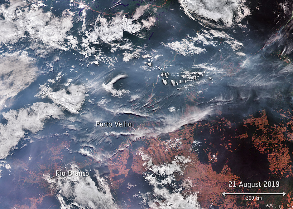
Amazonas wildfires spotted by Sentinel satellites
2019-09-02
Often called ‘the lungs of the world’ because it provides 20% of the world's oxygen, the Amazon rainforest has been ablaze for weeks. Copernicus Sentinel satellites have captured images of the billowing smoke from the catastrophic fires, which continue to spread.
Read more
Supporting the urban development in Chișinău
2019-08-07
Chișinău is the capital and largest city of the Republic of Moldova and the country’s main industrial and commercial centre and transportation hub. While still being the least urbanised European country with over 55% of the population residing in rural areas (as of 2014), particularly Chișinău is…
Read more
LULUCF Monitoring and Reporting Systems for Turkey
2019-07-09
GeoVille is delighted to announce the final implementation of the Land Use Land Use Change and Forestry (LULUCF) Monitoring and Reporting System for Turkey. The new satellite-based monitoring system eliminates many of the previous shortcomings in the estimation of national Activity Data (AD) and the…
Read more
Connecting citizens with satellite imagery
2019-06-07
LandSense uncovers the potential of citizen science and Earth observation to improve the way we see, map and understand the world. This week, the LandSense Year 3 Workshop tool place at IIASA in Laxenburg, Austria to discuss the progress of the project as well as to exchange experiences from the…
Read more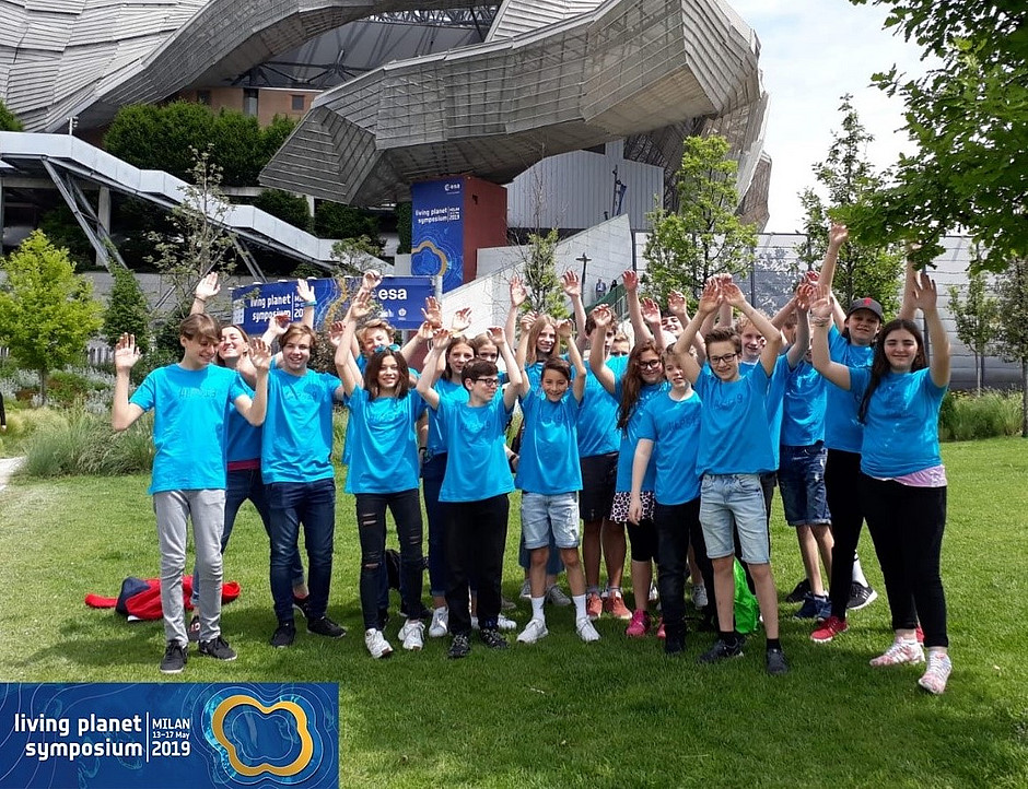
Living Planet Kids powered by GeoVille!
2019-05-19
Last week ESA’s Living Planet Symposium 2019 took place in Milano, Italy. GeoVille sponsored the participation of Innsbruck’s Adolf-Pichler-Platz (APP) high-school kids.
Read more
Register now! Agro-insurance consolidation workshop
2019-04-12
In the last few years there has been a fast growth in the amount of Earth observation (EO) data acquired from space. New ways to enable its exploitation may offer many opportunities to various industries. To extract the full EO potential for the agro-insurance sector, the European Space Agency (ESA)…
Read more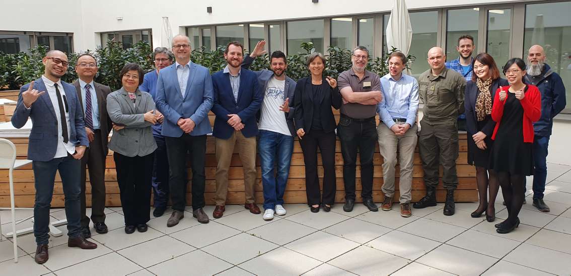
QuinJunSAT live demonstration
2019-04-11
This week, the QuinJunSAT consortium partners from GeoVille, The Austrian Institute of Technology (AIT) and GeoThings have been meeting at the AIT in Vienna to present the project outcomes to the Austrian Research Promotion Agency (FFG). The meeting provided the opportunity for the invited…
Read more
Empowering decision makers in Peru
2019-04-09
The EO4SD Water team is just back from Peru after a well-organised and highly interesting Earth observation seminar and training workshop.
Read more
View from the Sky - The contribution of EO to the SDGs
2019-03-04
This week, GeoVille and its partners UN Environment World Conservation Monitoring Centre (UNEP-WCMC), DHI-UNEP and DHI-GRAS are meeting with Marc Paganini at ESA-ESRIN to discuss the latest updates and developments of the ESA-funded “Earth Observation for the Sustainable Development Goals” project.
Read more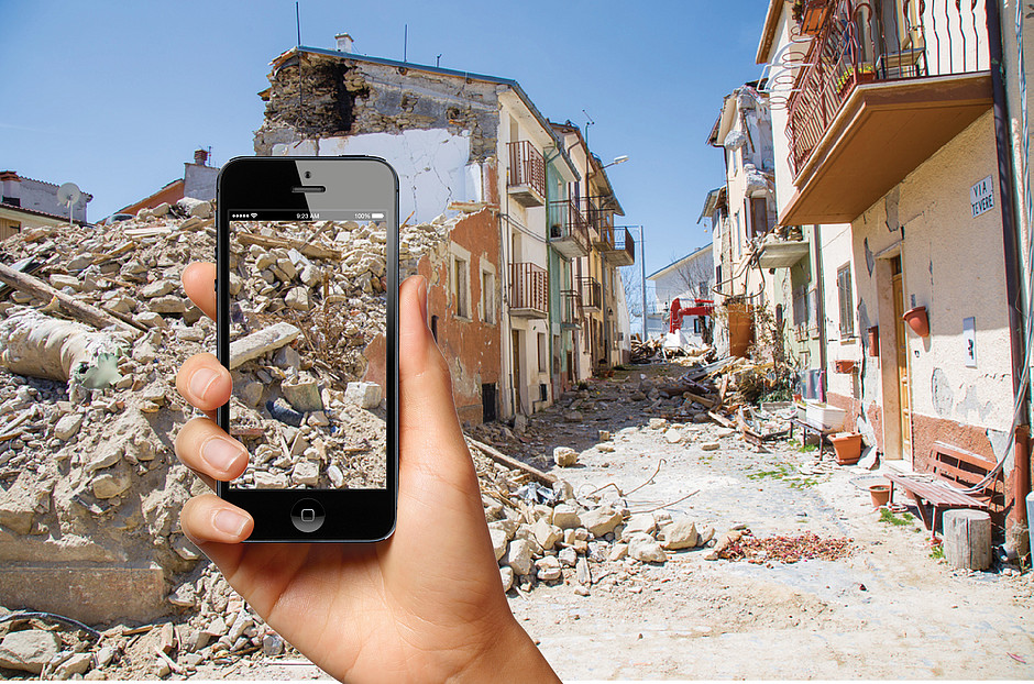
QuinJunSAT – Improved situational awareness
2019-02-19
Disasters have complex and deeply disruptive effects on the livelihoods of the affected people. The conditions after a crisis incident can be extremely chaotic and difficult to grasp for both, the population hit by the event as well as the first responders.
Read more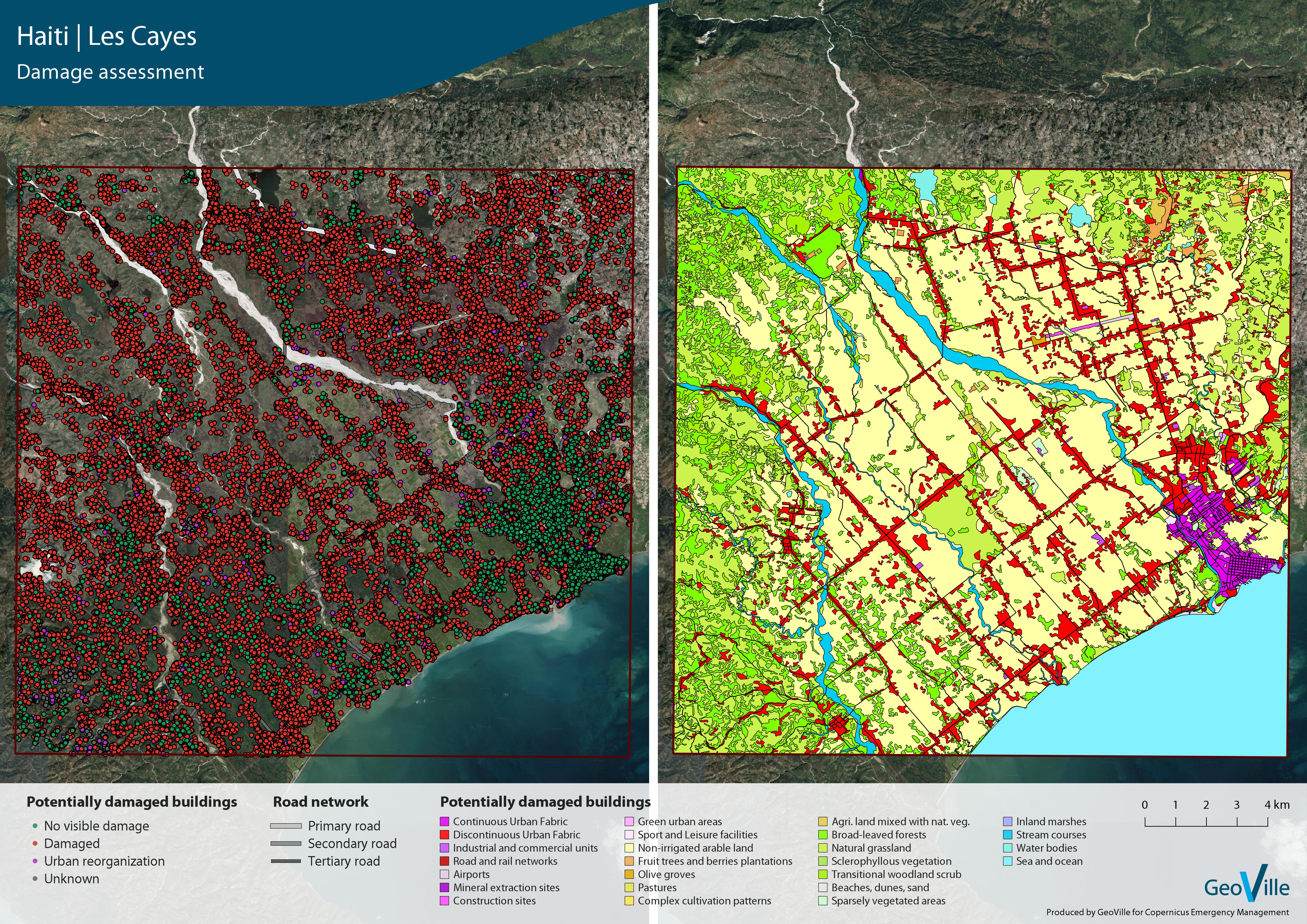
Assessing the impact of hurricane Matthew in Haiti
2019-01-24
Hurricane Matthew struck Haiti on October 4, 2016, as a Category 4 hurricane. The combined effects of wind, coastal flooding and rain caused heavy flooding, landslides, and the destruction of a great deal of infrastructure, agricultural crops and natural ecosystems.
Read more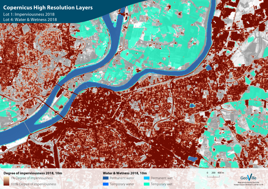
New contracts for Copernicus Land Monitoring Services
2018-12-19
We are delighted to announce that GeoVille was contracted by the European Environment Agency (EEA) to implement the update of the Copernicus High Resolution Layers (HRLs) Imperviousness and Water & Wetness.
Read more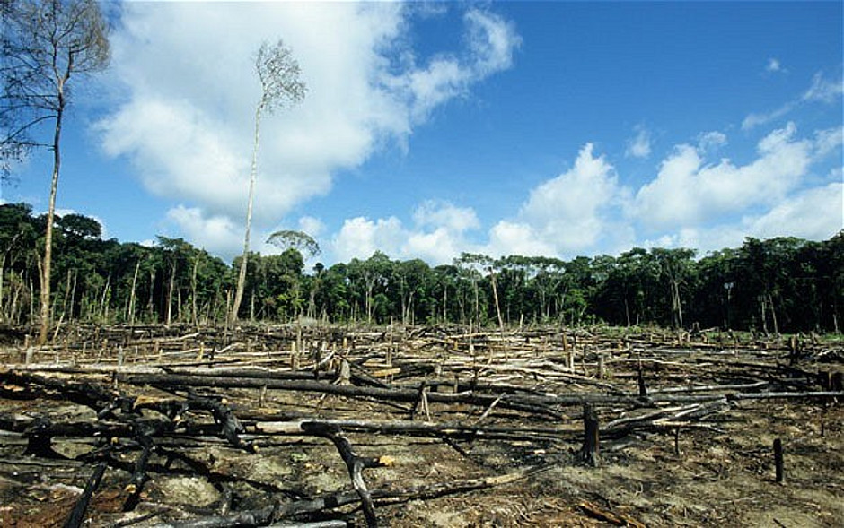
Supporting environmental law enforcement
2018-12-13
We are excited to announce that we just kicked off EnviroLENS, a Horizon 2020 project funded by the European Commission which will bring together information derived from satellite monitoring technology along with existing environmental laws and use it as direct evidence for law enforcement.…
Read more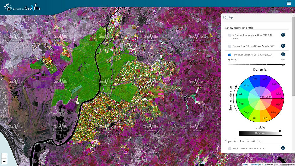
New product releases on LandMonitoring.Earth
2018-12-10
At the occasion of the ‘European Land Monitoring at its crossroads’ conference held in Innsbruck, Austria, in October, GeoVille has released an update of the LandMonitoring.Earth public portal.
Read more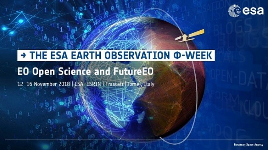
The future of EO: Investigating industrial innovation
2018-11-13
Our colleague Dr. Eva Haas has been invited to be part of a roundtable panel discussion at the ESA Earth - Φ-week event on 13th November. The ESA Earth - Φ-week is focusing on EO Open Science and Future EO and is hosted in ESA-ESRIN from the 12-16 November 2018. Aim of the phi-week is among others…
Read more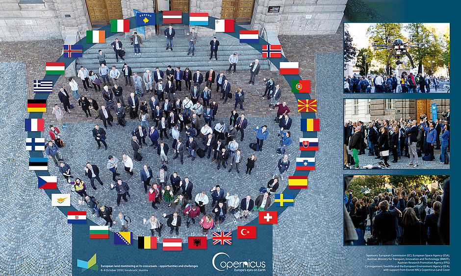
European land monitoring at its crossroads – opportunities and challenges
2018-10-21
On 8 and 9 October, we were hosting a conference on "European land monitoring at its crossroads - opportunities and challenges" in Innsbruck. Even if you hadn't time to personally attend, you can still watch the video of the conference below.
Read more
I-REACT showcases technological capacities
2018-10-15
Last week our colleague Florian Girtler attended a technical meeting for discovering the capabilities of the I-REACT multi hazard tool in Barcelona. I-REACT partners of Meteosim, UNESCO and ISMB where in charge of presenting the available set of tools against disasters during a workshop including…
Read more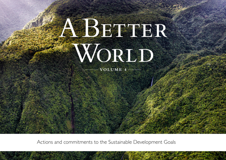
GeoVille contributes to A BETTER WORLD Vol. 4
2018-08-22
An article on the latest outcomes of the EO4SD-Agriculture and Rural Development Cluster has been published in the book “A BETTER WORLD: Actions and commitments to the Sustainable Development Goals Human Development Forum”. The article features first results and demonstrates how EO-derived…
Read more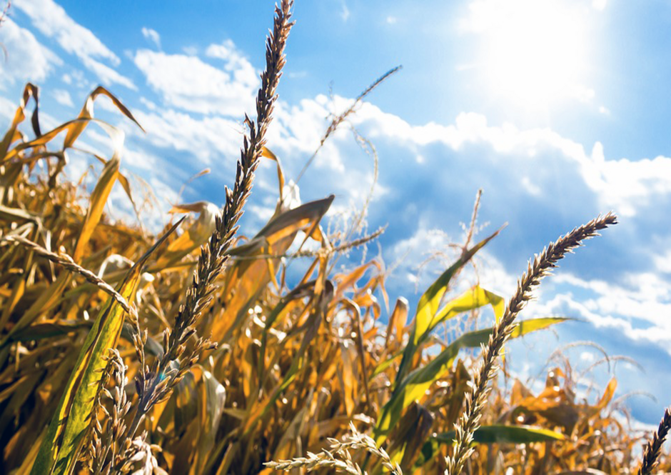
Record drought in Germany spotted by satellites
2018-08-03
In the last month, Germany has received only about half of its normal annual rainfall. In many parts of the country the water level in rivers has reached its lowest level in a century and farmers are grappling with poor harvests as a result of higher than normal temperatures combined with a lack of…
Read more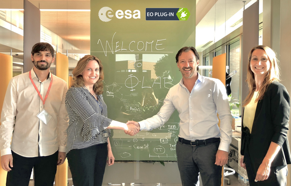
ESA ɸ-lab – first InCubed activity launched
2018-07-13
With the successful EO PLUG-IN kick-off meeting on 12th July at ESRIN, Frascati, GeoVille and partners (EODC, Hermess, HLB) are first to start the InCubed programme activities at ESA’s brand new ɸ-lab. EO PLUG-IN will enable a easy access to continuous business intelligence data streams for the…
Read more
Come visit us at the AGIT EXPO
2018-07-05
We are currently attending the AGIT Symposium and EXPO in Salzburg, a platform for dialogue among geospatial minds, creating an informed GeoInformation Society, hoping to contribute to a more just, ethical and sustainable society.
Read more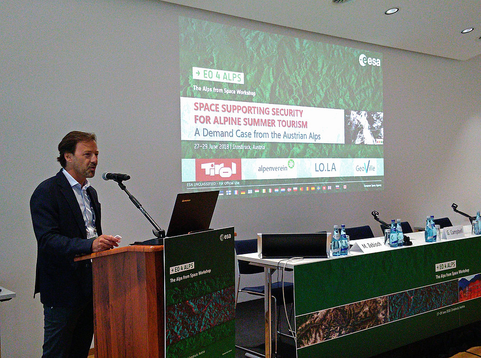
The Alps from space workshop in Innsbruck
2018-06-29
This week representatives from public services, science and industry are meeting in Innsbruck to assess opportunities for Earth observation (EO) research and development as well as downstream activities that may be the basis for future investments of the European Space Agency (ESA).
Read more
Solutions for ageing populations
2018-06-27
Population ageing is a key challenge for all highly developed societies over the coming decades and will have a major impact on the economy. But where exactly do the elderly live? To efficiently target the ageing population, it is of utmost importance to have location-based information on the…
Read more
Austrian Space Cooperation Days
2018-06-07
We are currently attending the Austrian Space Cooperation Days 2018 (ASCD 2018) in Wiener Neustadt. The ASCDs aim to open up the traditionally national Space Days into a platform for exchange and networking among industries and research institutions of small and medium space countries in Europe.
Read more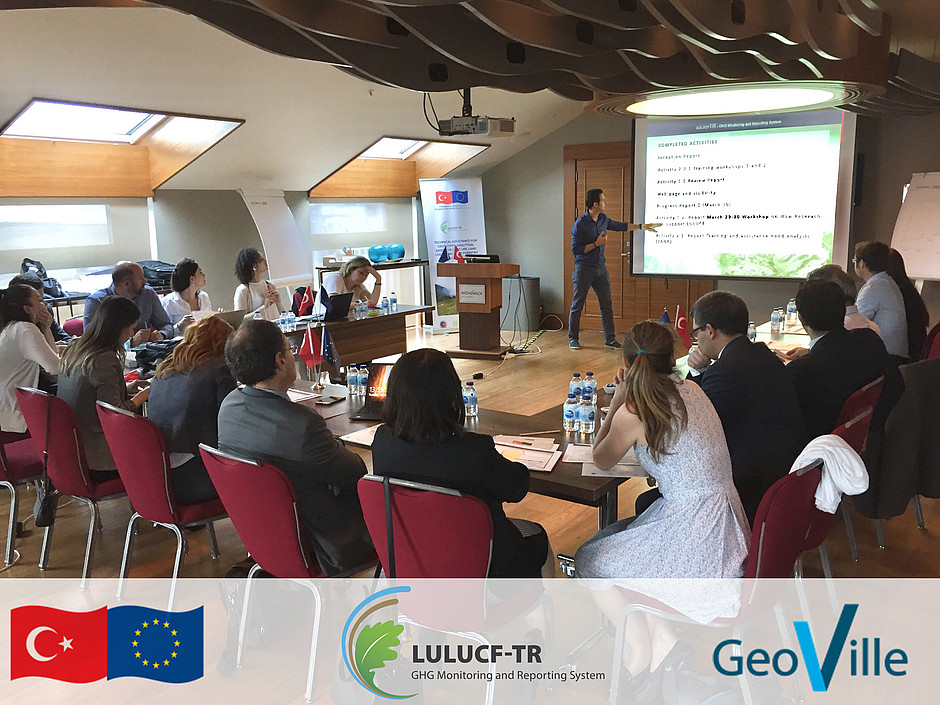
LULUCF Turkey: 3rd Steering Committee Meeting
2018-05-29
GeoVille commences project component 4 activities aimed at the development and implementation of an EU and UNFCCC compliant satellite based monitoring system in support of highly accurate, TACCC compliant annual Activity Data for the LULUCF sector from 1990 until 2015.
Read moreProviding EO-based Climate Resilient solutions for global sustainable development
2018-05-25
Climate change is challenging the sustainable development of our planet and puts billions of people at risk. The European Space Agency's new Climate Resilience project is an exciting new initiative which aims to promote Earth Observation data as the best tool to provide decision-makers with decisive…
Read more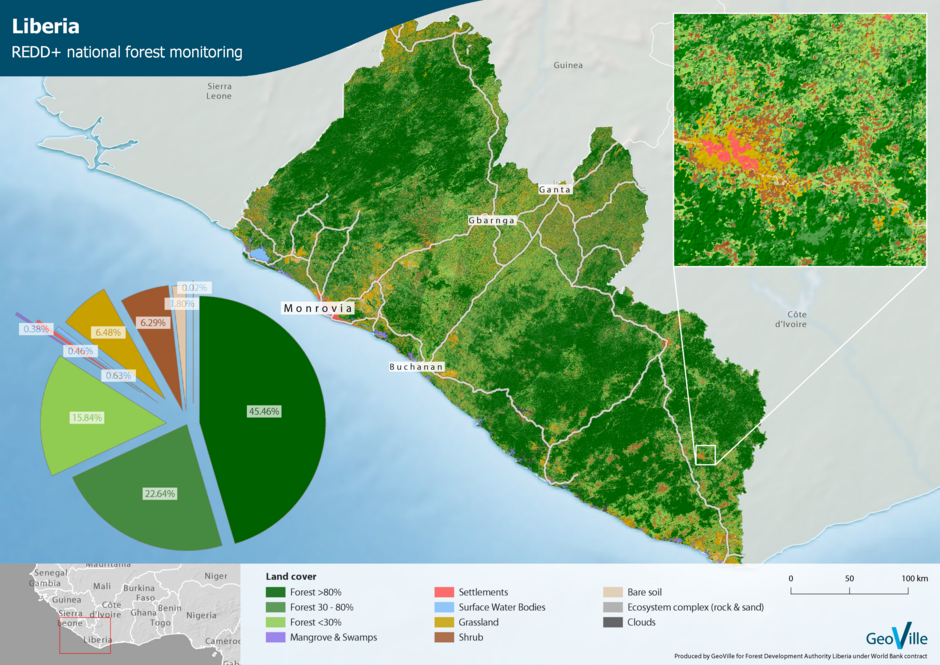
REDD+ Forest and Plantation Mapping in Liberia
2018-05-18
In Liberia more that 40% of the land is covered with forest and the country is considered as one of West Africa’s most important carbon sinks and biodiversity hotspots. The Liberian Government recognizes the importance of their natural forest resources and works toward a national REDD+ forest…
Read more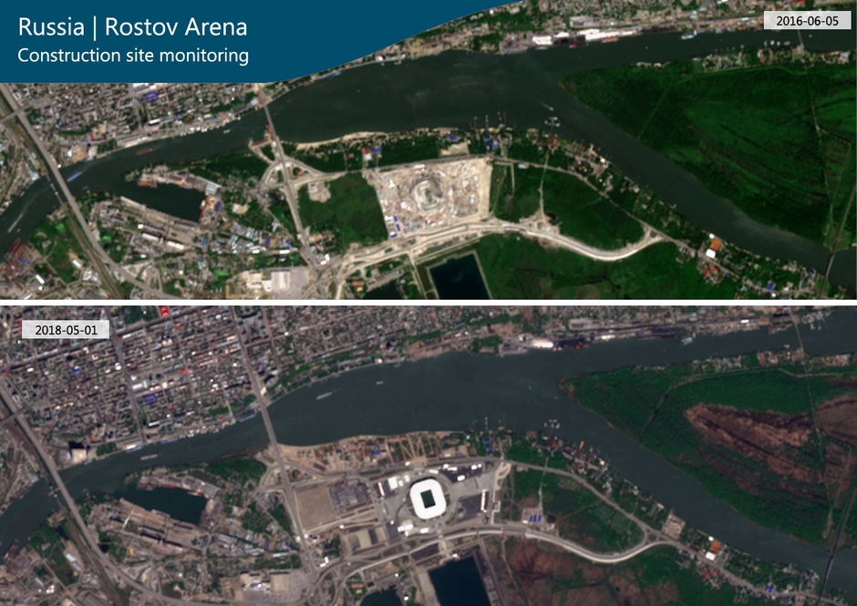
Russia is ready to kick off the FIFA World Cup
2018-05-11
In about one month the FIFA World Cup 2018 will start in Russia. In Austria we have had our difficulties to qualify for the tournaments in previous years, that’s why we are used to watch the championships remotely from our homes. This time, however, we might have taken it too literally when we…
Read more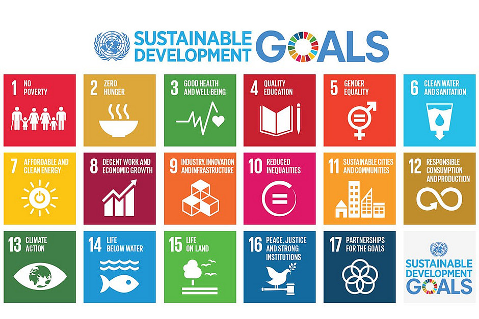
Contributing to the UN Sustainable Development Goals
2018-04-23
The decreasing cost of satellite data in the past decade, along with the launch of the ESA Sentinel mission, has made Earth observation (EO) and geospatial information more attractive than ever for addressing global challenges like poverty, monitoring environmental changes, and stimulating economic…
Read more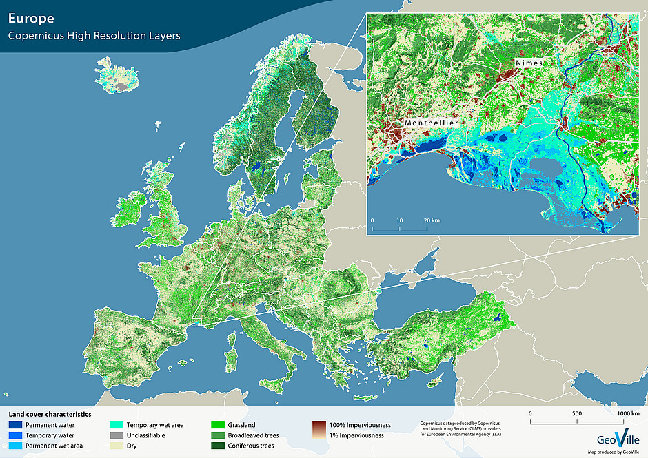
Release of Copernicus High Resolution Layers
2018-04-16
We are delighted to announce that the new Copernicus High Resolution Layers (HRLs) for the reference year 2015 are now available online via the CLMS portal.
Read more
Towards a national land monitoring system for Turkey
2018-04-05
GeoVille has conducted a 2-day workshop in Istanbul at TÜBITAK, the largest research organisation of Turkey, to support the national feasibility study for the implementation of an Earth observation based national land monitoring system in Turkey (UASIS).
Read more
First, validated Sentinel-2 based land cover map
2018-04-04
In order to meet the reporting obligations from international conventions, European directives and national legislations, countries are required to produce up to date, detailed and harmonised information on their land cover and its use, at different scales and for different domains of applications.…
Read more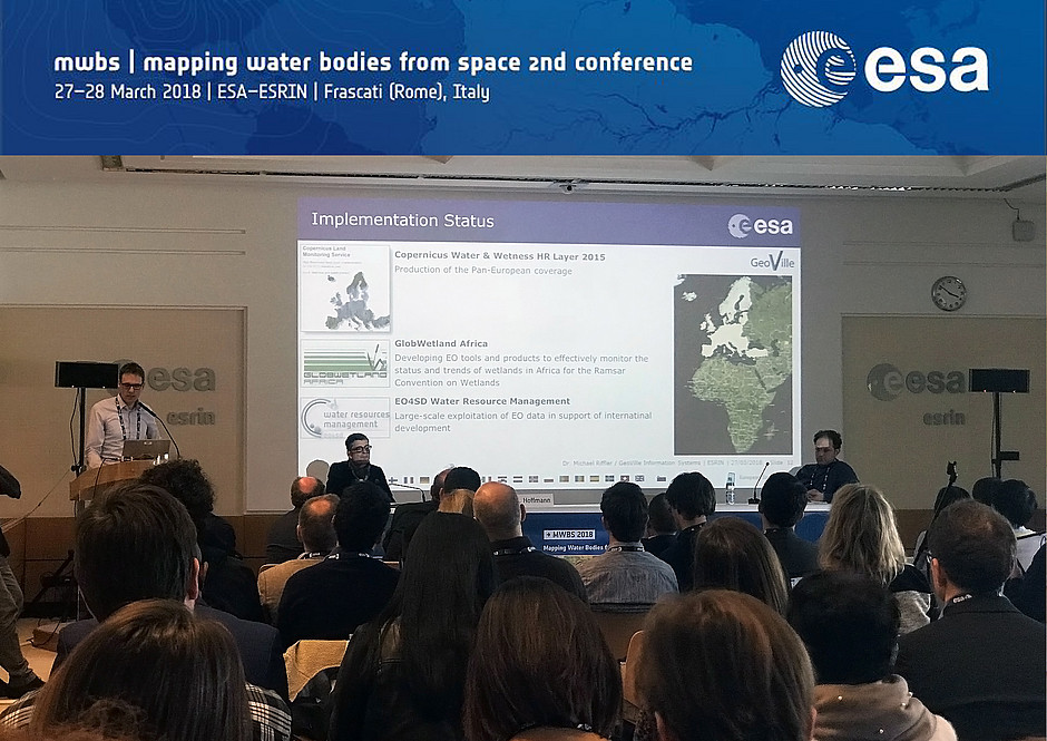
Mapping water bodies from space
2018-03-27
The detection and consistent mapping of surface water is a baseline requirement for scientific research, political and economic decision-making. When time series are considered, significant natural and anthropogenic changes and trends in the state of the Earth’s environment can be identified and…
Read more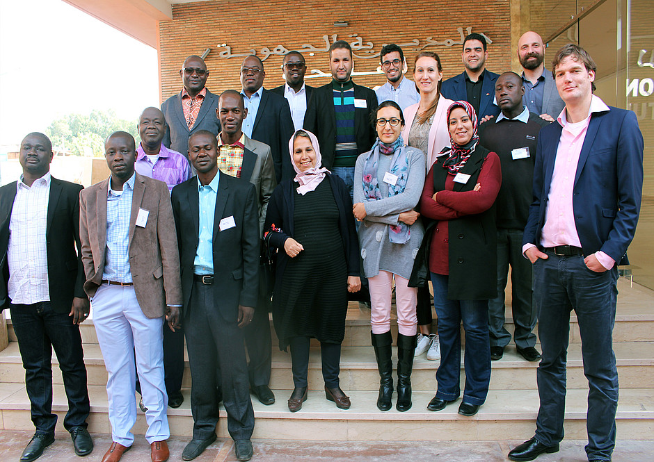
Building Earth observation capacity in Africa
2018-03-19
GeoVille and ITC supported by partners from the EO4SD Agriculture cluster held a 5-days capacity building workshop in Marrakech (Morocco) at the Direction Regional de l´Agriculture (DRA) from 12 to 16 March. The aim of the workshop was to inform participants on how the EO4SD services can provide key…
Read more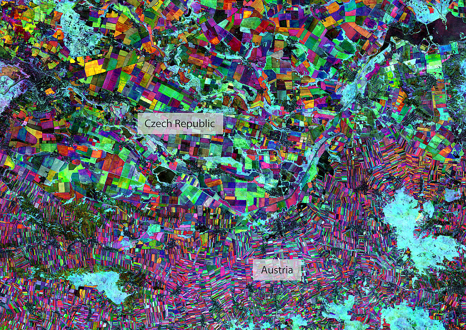
Are European national borders visible from space?
2018-03-12
With every expansion of the European Union the relevance of national borders is decreasing. Free movement of persons inside the European Union makes travelling very convenient and in most cases no country borders are perceived. But how do these look from space?
Read more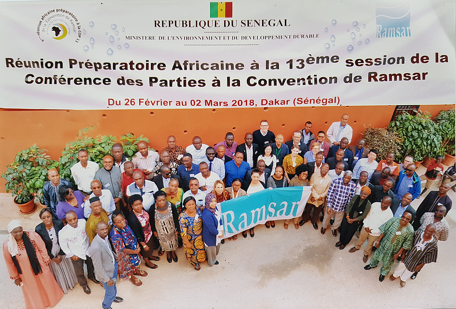
Implementing sustainable wetland monitoring
2018-03-05
GeoVille and its partners had a successful technical training workshop in Dakar, Senegal, hosted by SenegalWet and arranged as a side meeting to the Ramsar African Regional Preparatory Meeting. The main objective of the workshop was to present the first official release of the GlobWetland Africa…
Read more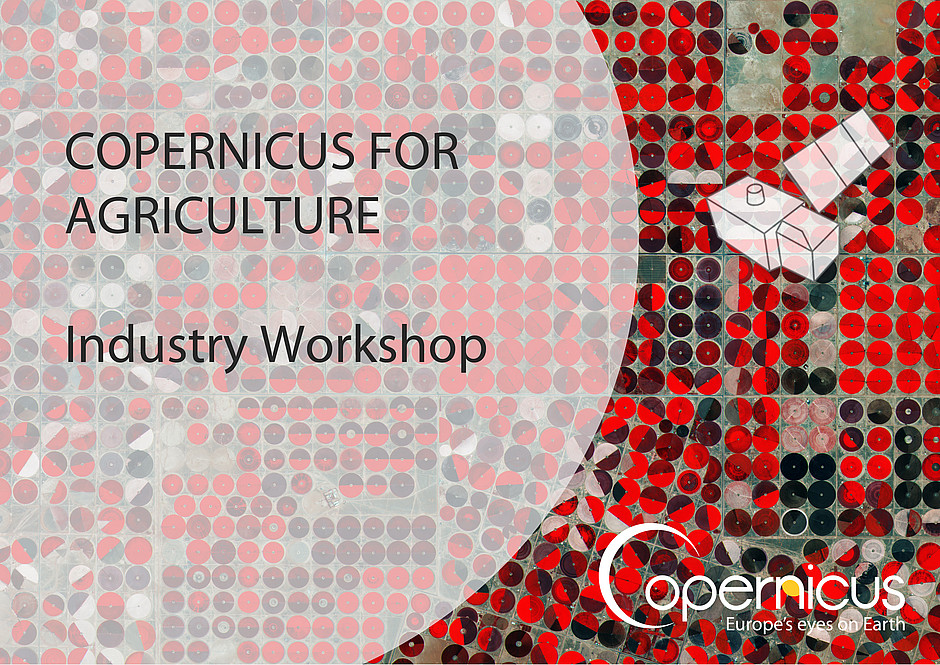
Growing global opportunities in the agricultural sector
2018-02-19
At the recent Copernicus for Agriculture Industry Workshop held in Brussels on 5 February 2018, GeoVille presented the ‘Growing global opportunities in the agricultural sector' from a European EO industry perspective.
Read more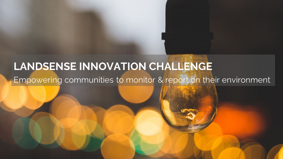
Got a great idea for the LandSense challenge?
2018-02-05
As part of the LandSense Consortium, GeoVille is excited to announce the first LandSense Innovation Challenge aimed at boosting further developments in Land Use and Land Cover (LULC) solutions, while bringing citizen science and Earth observation closer together.
Read more
Building new businesses on Copernicus' Sentinel data
2018-01-29
Free and open access to high temporal and high spatial resolution Copernicus’ Earth observation data is becoming a major game-changer in EO sector, delivering new opportunities as well as new challenges at the same time.
Read more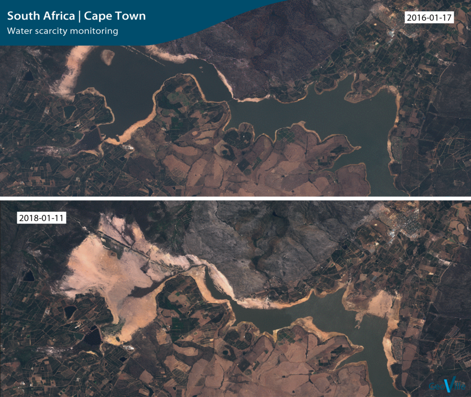
Uncovering Cape Towns water crisis
2018-01-22
Cape Town is the first major city in the world that might soon run out of water. Water reserves are at a historical low and the cities water taps are estimated to run dry within 90 days. The historically low dam levels of the city of Cape Town are triggered by three years of unprecedented drought…
Read more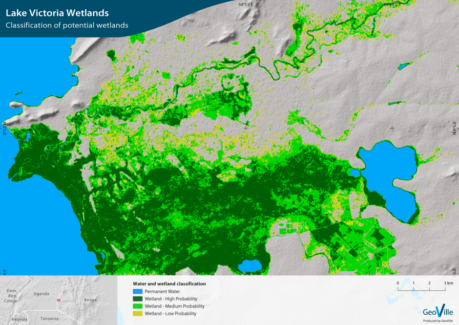
Implementing a wetland monitoring capacity
2018-01-08
GeoVille and its international partners DHI GRAS and ITC are currently cooperating with national authorities in Uganda to develop and implement a user-friendly wetland monitoring system. The system will provide an operational capacity to generate spatial time series statistical data for…
Read more
Merry Christmas and a happy New Year 2018
2017-12-22
We send you best wishes for a well-deserved Christmas break.
Read more
Bringing Earth observation into IFAD operations
2017-12-18
GeoVille and partners are working closely with the International Fund for Agricultural Development (IFAD), both at the headquarters in Rome and in the targeted countries, to foster the usage of Earth observation in their operations.
Read more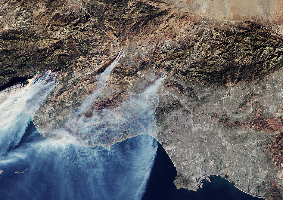
Ongoing Californian wildfires captured from space
2017-12-10
California has endured its worst year of wildfires on record - until now more than 1000 ha have burned and thousands of homes and business have been destroyed. This Sentinel-2 satellite image captured on 5th of December gives an insight on this destructive force from space.
Read more
Production and distribution of Sentinel-2 global mosaic
2017-12-04
We are excited to announce that GeoVille, as part of a consortium together with Brockman Consult and Synergise, has been awarded a European Commission contract to build a service for the production and distribution of global Sentinel-2-based mosaics.
Read more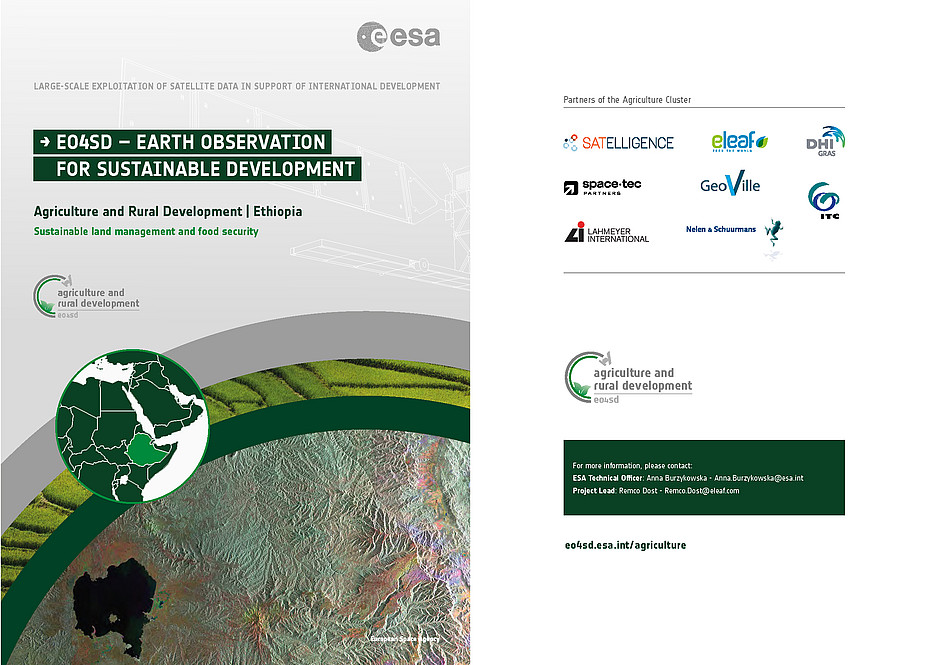
EO-based geo-information solutions to support agricultural monitoring
2017-11-19
The EO4SD – Agriculture and Rural Development Cluster project supports programs and projects of International Financial Institutions and their local stakeholders in Latin America, Asia and Africa. The aim is to demonstrate benefits of EO-based geo-information products and services to support…
Read more
Earth observation and economics
2017-11-13
GeoVille discussed the potential of Earth observation for economic analysis during a meeting with representatives from Deutsche Bank Research and Deutsche Asset Management in Frankfurt last week.
Read more
Wall-to-wall land monitoring system for Turkey
2017-11-08
We are delighted to announce that the European Union External Action (EuropeAid) contracted GeoVille to implement the "Technical Assistance for Developed Analytical Basis for LULUCF Sector" project in Turkey together with its international partners A.E.S.A. and DKM. The objective of the project is…
Read more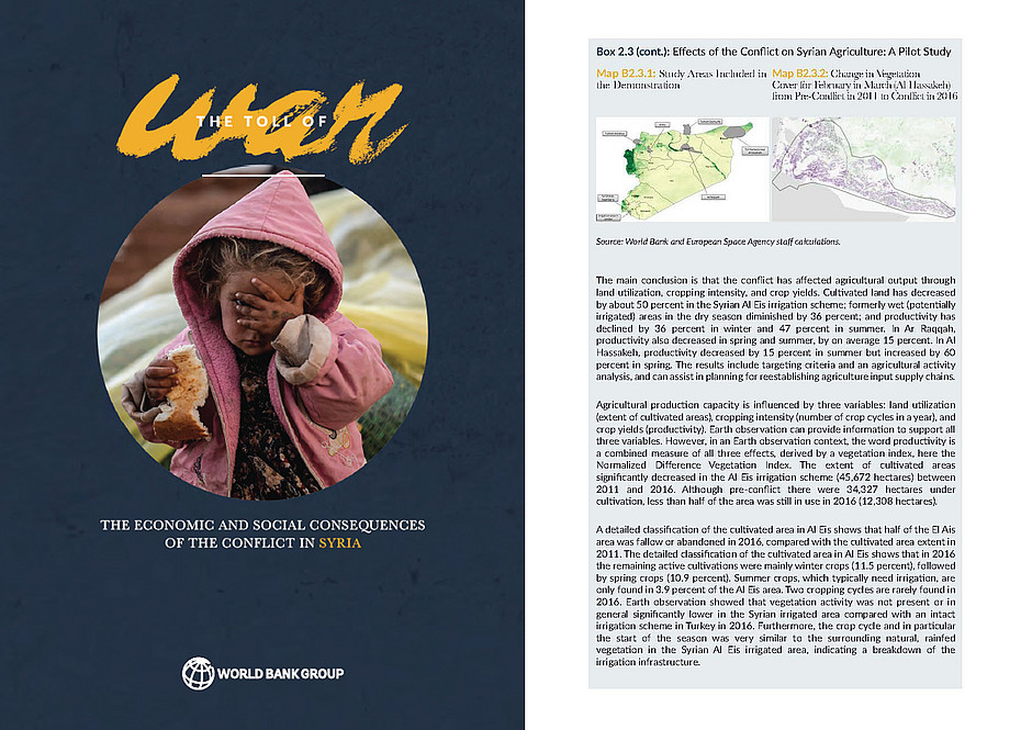
The Toll of War: assessing agricultural production losses
2017-10-30
GeoVille has provided technical assistance to the World Bank in the framework of the ESA EO4SD - Earth Observation for Sustainable Development initiative, mapping temporal and spatial changes in the land cover of agricultural areas related to the armed conflict in Syria.
Read more
GeoVille featured in summer eomag: 50th edition
2017-07-15
GeoVille has been featured in the summer eomag: 50th edition 2017. The article focusses on GeoVilles expertise in land monitoring for coastal zone and water management.
Read more
Extending the Copernicus Local Land Component
2017-07-10
We are delighted to announce that the first delivery unit of the Copernicus Natura 2000 Local Land Component containing around 22.000 km2 has been delivered to the European Environment Agency (EEA).
Read more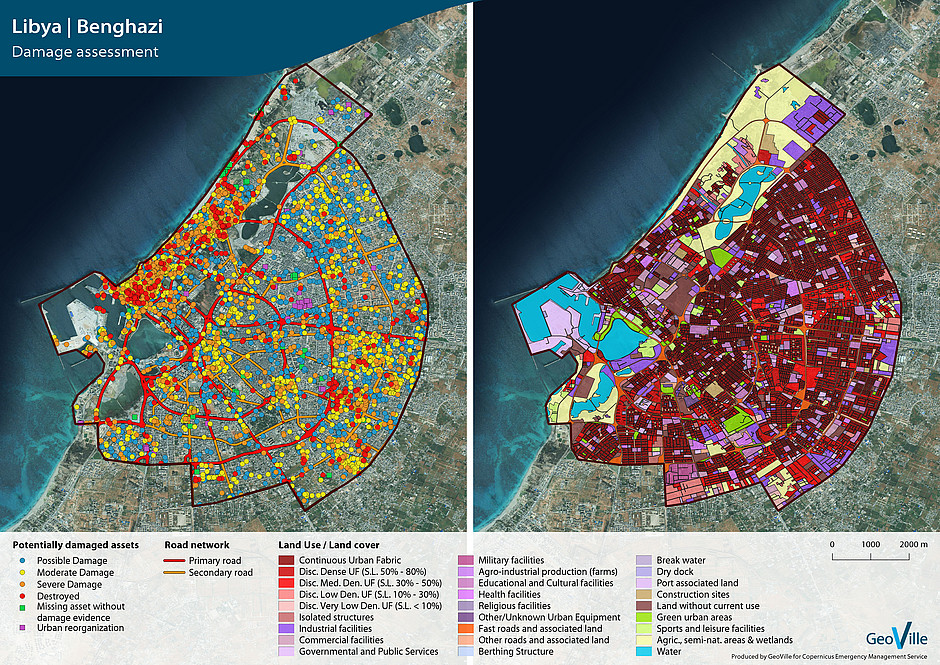
GeoVille performs conflict damage assessment in the Libyan city of Benghazi
2017-06-01
GeoVille generated maps related to damage assessment following the violent conflict, started in May 2014, between parties in Libya. The objective of the assessment is to provide an overview of the level of damage to housing/buildings and public infrastructure that will allow local authorities and…
Read more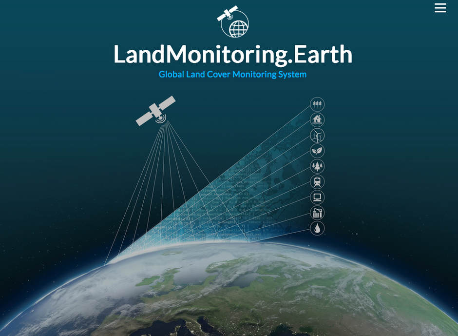
GeoVille launches LandMonitoring.Earth
2017-03-27
GeoVille put together 20 years of experience and launched a new land monitoring system for automatic Land Cover mapping built on Sentinel data streams fulfilling multi-user application requirements.
Read more
GeoVille kicks-off the Horizon2020 EO VAS project
2017-03-01
Today marks the start of a new project, bringing an even better value to Copernicus data. We are excited about the potential of the "Earth Observation Value Adding Services (EO VAS)" project and the cooperation with Sinergise - a GIS IT company situated in Ljubljana, Slovenia.
Read more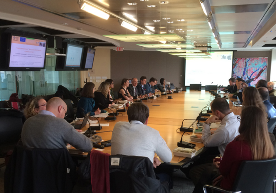
Forest dependency study presented at World Bank
2017-02-01
GeoVille, together with representatives of the International Union for Conservation of Nature (IUCN) presented their recent efforts to refine existing and develop new diagnostic tools to measure different dimensions of forest dependence at the World Banks Brown Bag Lunch (BBL) at Washington, DC.
Read more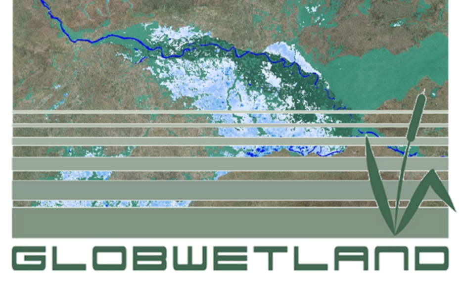
Wetland Monitoring for Ramsar in Africa
2017-01-12
GeoVille, together with DHI GRAS (Denmark), ITC (Netherlands) and Brockman Consult (Germany) as well as the technical universities in Copenhagen (Denmark) and Vienna (Austria), has been selected by the European Space Agency (ESA) to carry out the GlobWetland Africa Project.
Read more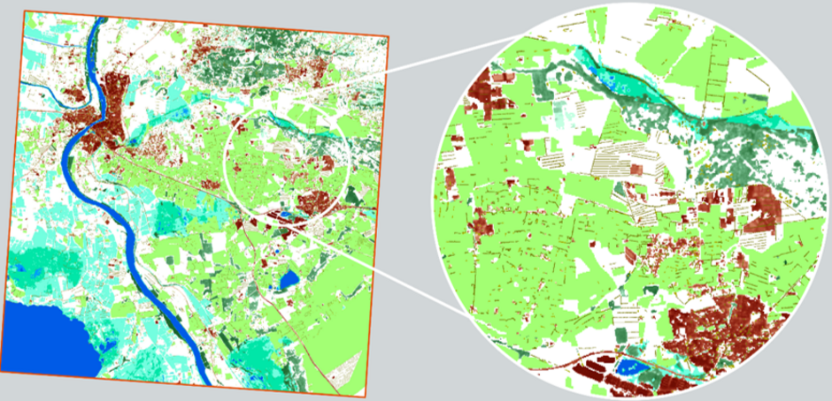
GeoVille implements Copernicus HR Layers
2016-09-22
The European Environment Agency (EEA) has recently contracted GeoVille GmbH and its international partners to implement the update of the Copernicus High Resolution Layers (HRLs) Imperviousness, Forest, Grassland, Water/Wetness and Small Woody Features in the frame of the continental component of…
Read more
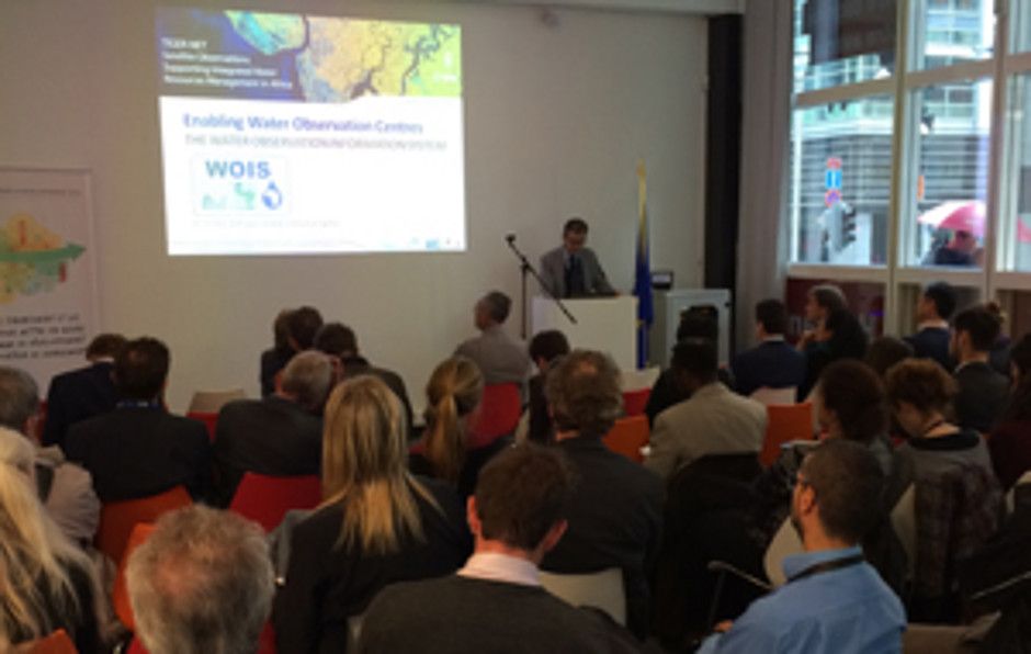
EC Conference on Earth observation
2015-06-30
Focus Africa - Water Observation and Information System WOIS. In an effort to promote the Water Observation and Information System (WOIS), Dr. Benjamin Koetz of ESA and Dr. Christian Hoffmann, CEO of GeoVille, hosted a presentation at the conference on Earth Observation for sustainable water…
Read more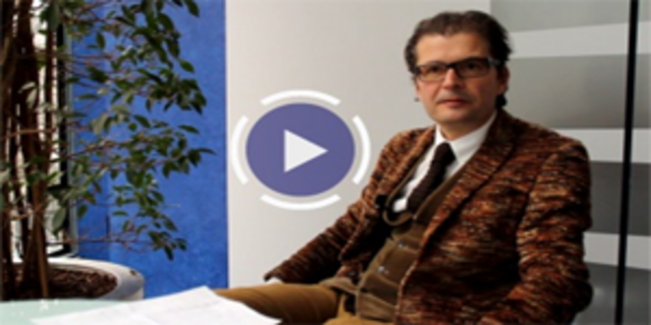
Copernicus interview with GeoVille´s CEO
2015-05-04
The recent issue of the Copernicus Observer features an interview with Christian Hoffmann, CEO of GeoVille GmbH, on GeoVille’s activities within Copernicus, current successes and future prospects.
Read more